
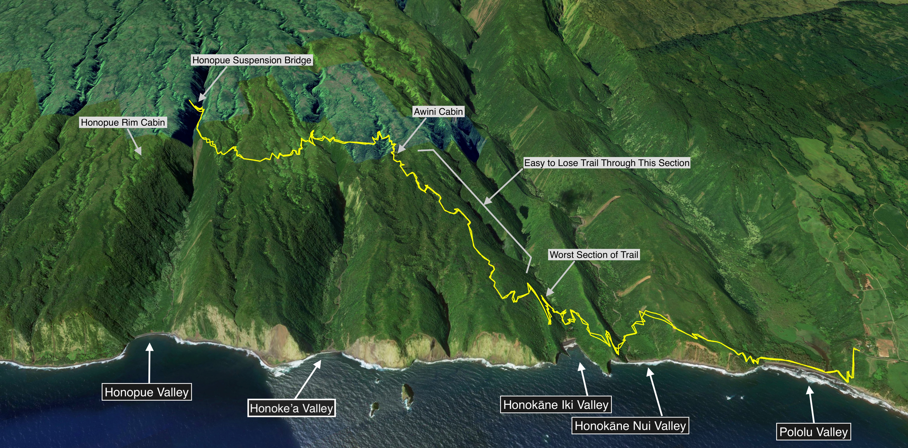
This adventure is a bit of a departure from my latest challenges. I wanted to get into the Honopue Valley from Pololu and though on maps it shows a trail all the way to the back of the Honopue Valley, this is not a trail that you can run very much of. In fact, this is a serious exercise in bushwacking and trail finding. I had gone out 5 days earlier with the intention of making it to the Honopue Valley beach and hardly covered 2 miles before I spent the next 2.5 hours bushwhacking and making almost no progress climbing out of Honokāne Iki. I had tried to follow the literal path shown on most maps as to where the Awini Trail climbed out of the valley and they started me too deep in the back of the valley. I wasted piles of time bushwhacking up pig trails. I made sure though on the way back down into Honokāne Iki Valley that I found the “correct” trail and discovered it was way off where all the maps start it. With this knowledge in hand, my second attempt was substantially more successful.
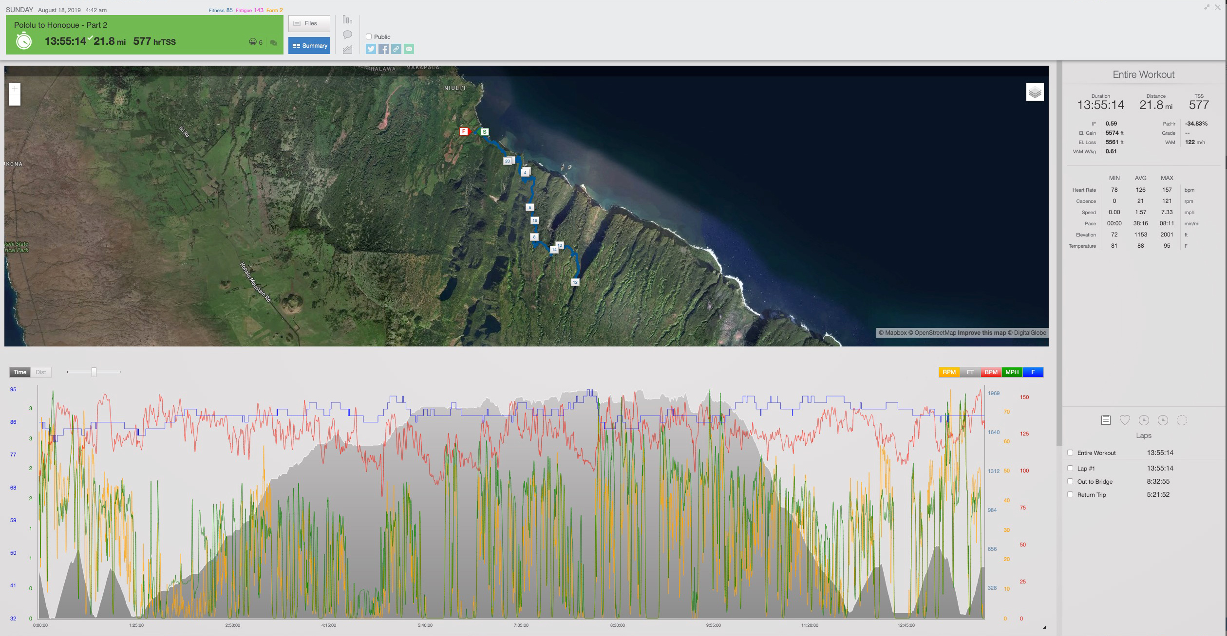
I started this journey at 3:15 am, August 18th, 2019 from my House in Kailua Kona. It takes about 75 minutes to get to the Pololu Lookout and by 4:40 am I was on the trail heading down into Pololu by headlamp. I knew this part of the trail now well and planned my early start accordingly. I was aware the trail was very manageable by headlamp to the valley floor of Honokāne Iki in 90 minutes and by that point, the sun would be up for the very challenging section of climbing out of this valley. All went according to plan and I was staring up my new nemesis as light filled the sky.
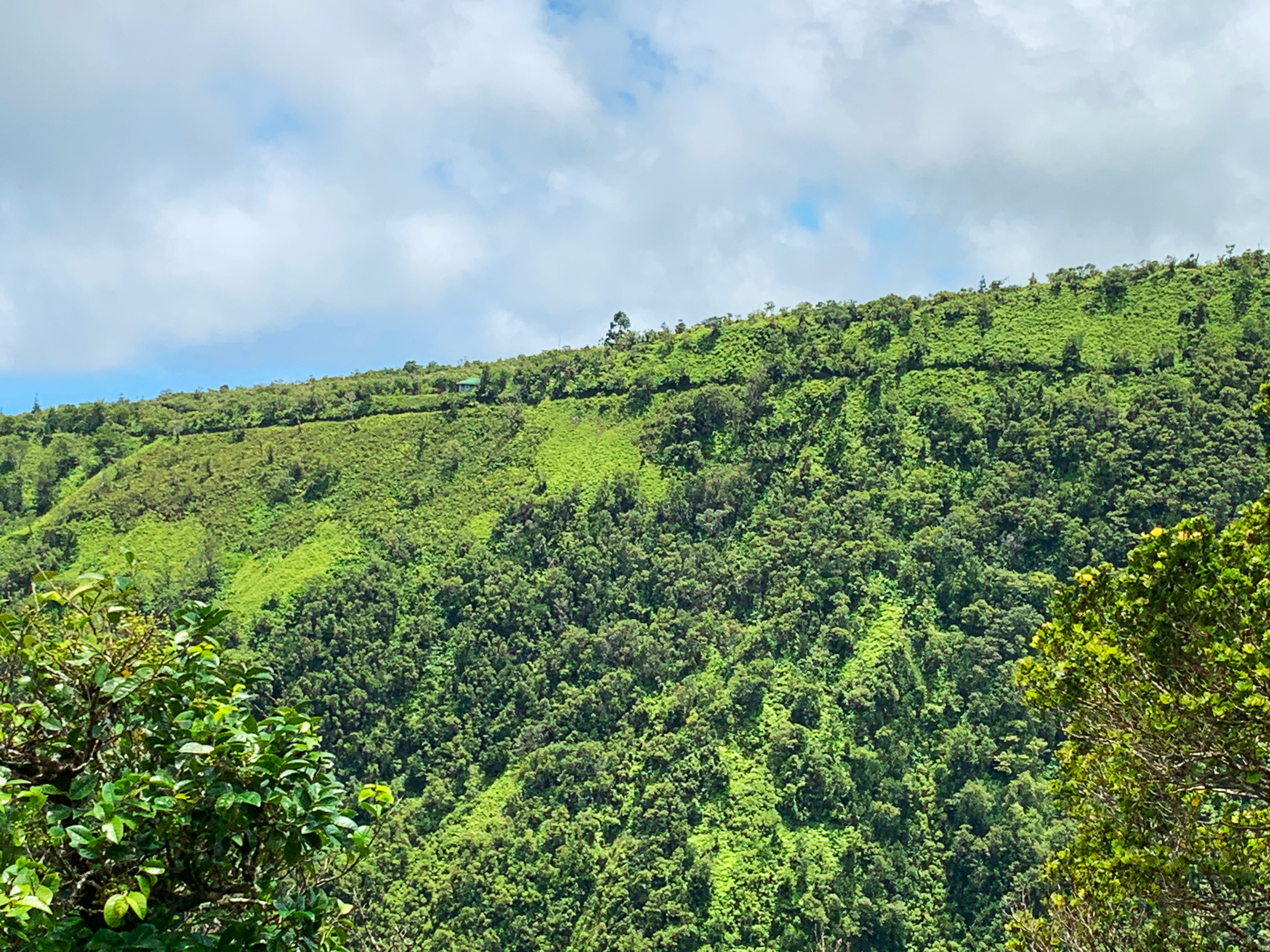
The climb out of Honokāne Iki up to its eastern rim is the hardest section of the entire trail. It makes no difference if you are going up or down this section of trail, you are slowed down heavily with obstacles. This section has seen very little travel since the Kiholo Earthquake in 2006 where many of the valleys had landslides that wrecked the trails. Then you add no maintenance for years, trees have fallen onto the trail, and overgrowth is rampant. I went through it the second time with a machete and maybe improved it by 3%. Expect a solid hour to climb out of the valley with a small pack on your back. You could try the pig trails straight up like I did the first trip out but the vegetation gets so dense so quickly that it truly was a bigger waste of time. And meeting up with the actual trail at the top was almost impossible to do since it is so overgrown, you’ll likely hike right past it.
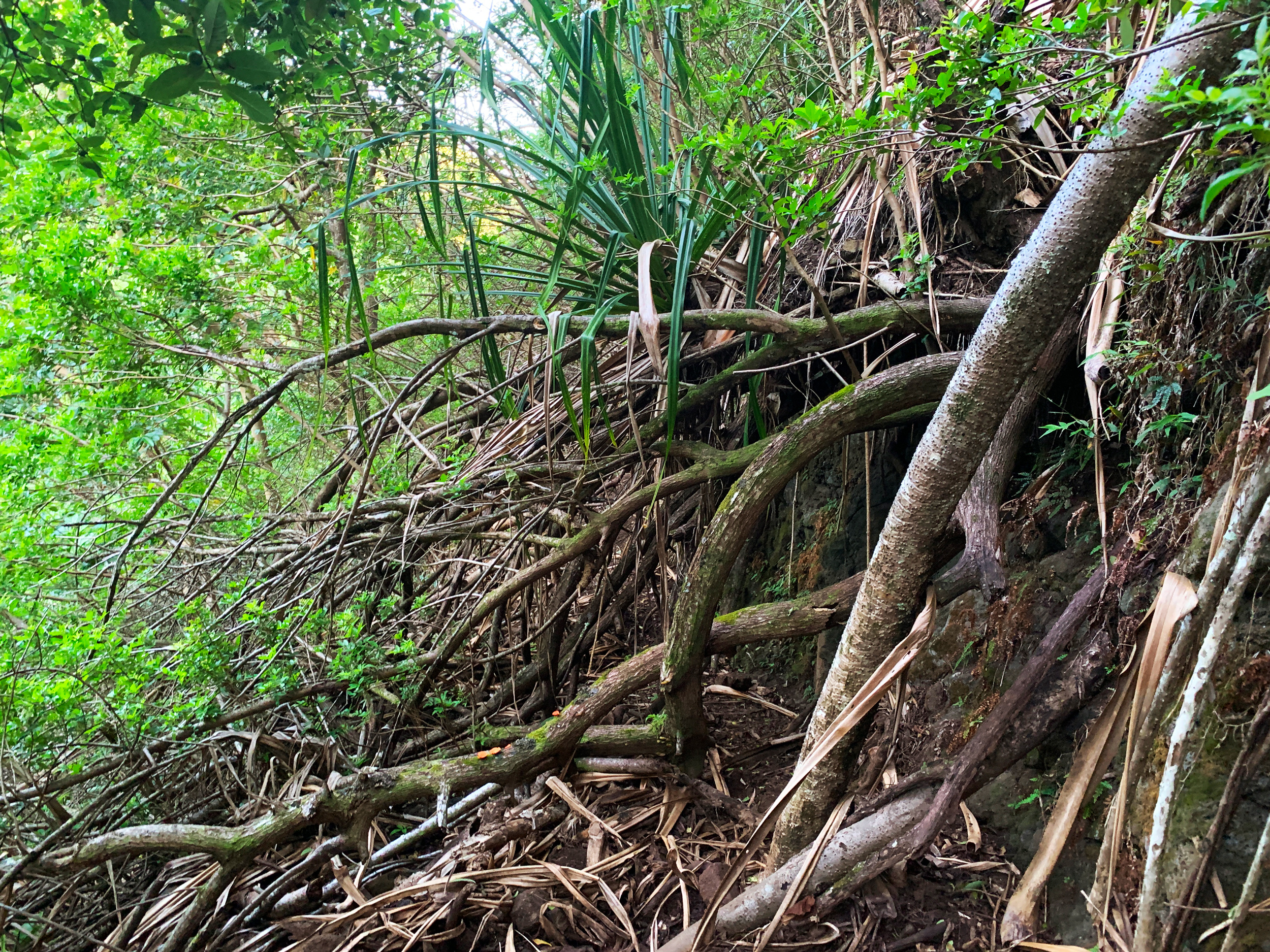
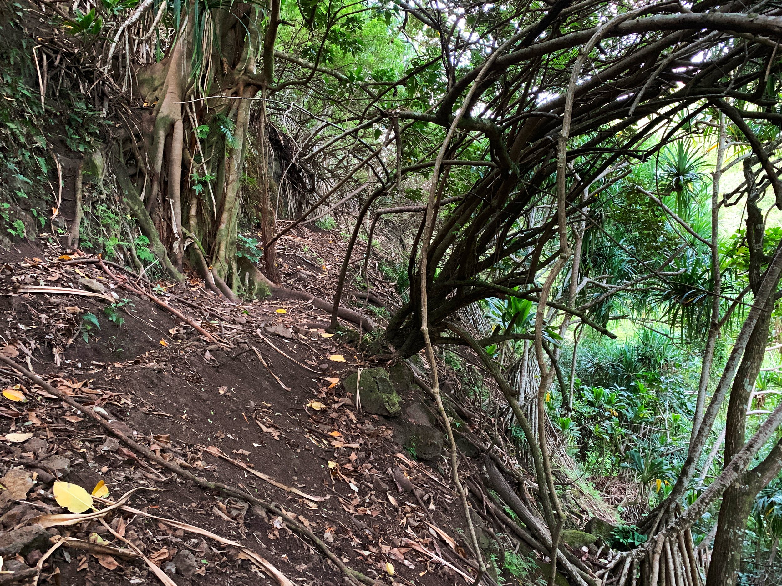
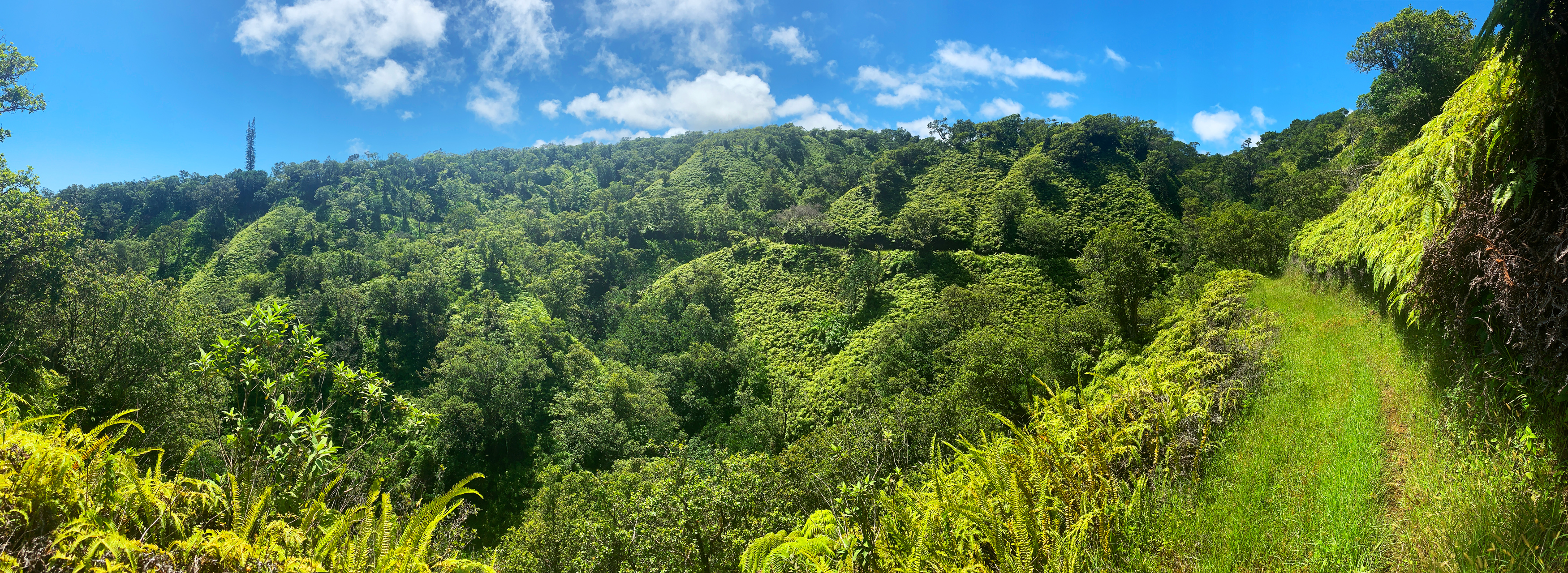
Once you get out of Honokāne Iki Valley the trail is so much more friendly – but hard to find and follow up to the Awini Cabin. What you need to keep in mind is that this trail was wide (like a car could fit on it) in most places so if you see a pile of tall grass and small trees between a corridor of taller trees then you are likely on the correct path. In these sections, you can get a great GPS reading of your location. But soon you will be under the forest canopy for a while and GPS will be practically useless. Pig trails go off all over the place but luckily they also travel along the “actual” trail so you are not doing a full bushwack through here.
I traveled through this section pretty smoothly yet I did go off-trail a few times. It’s just part of the process. You also have to understand the trail will also choke to just single track wide with dense trees on each side and if you are on the right path it will open up again in a few minutes. Otherwise, you are on a pig trail and you need to backtrack and ask yourself: “If I made this trail, where would it go”.
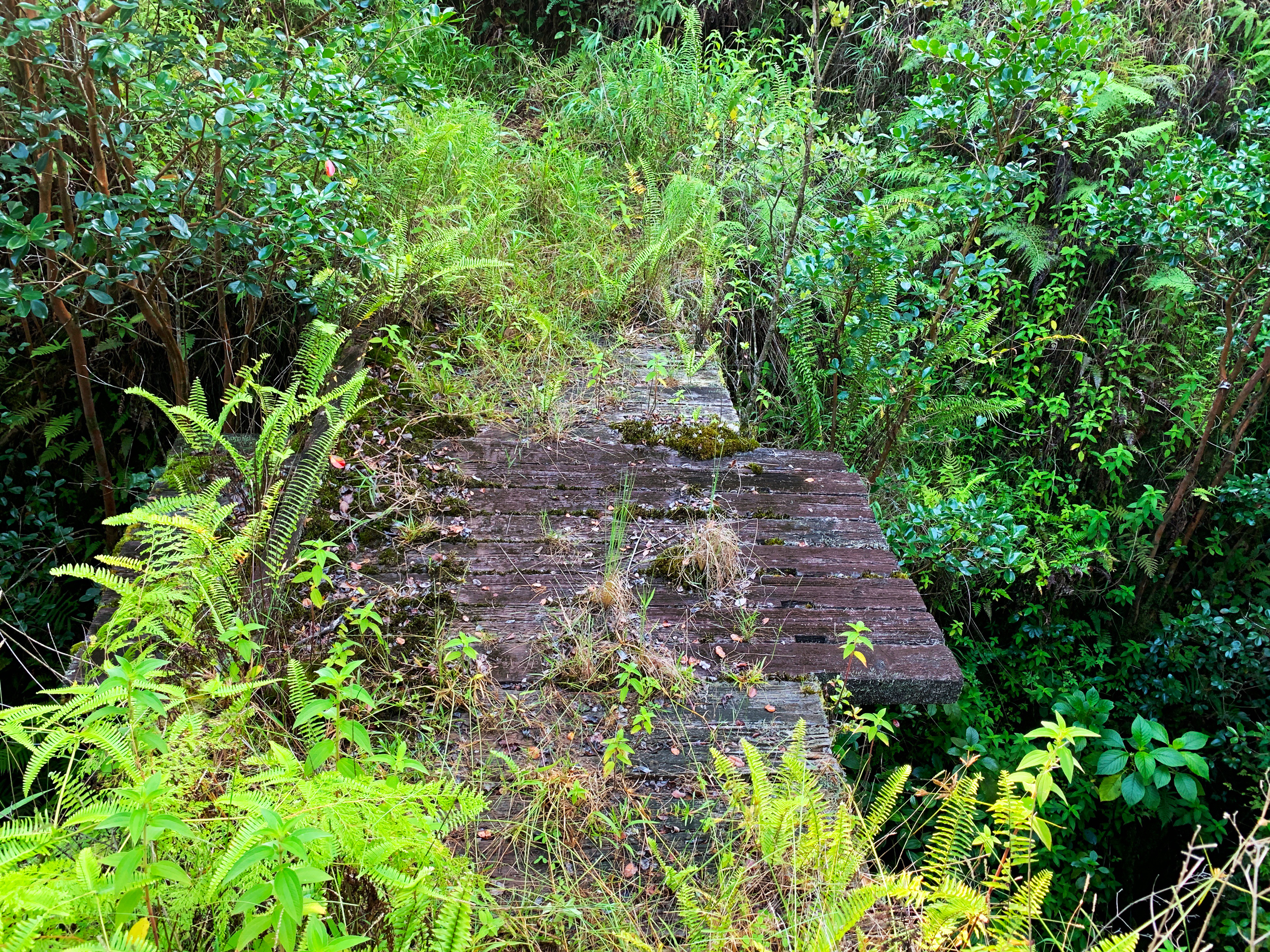
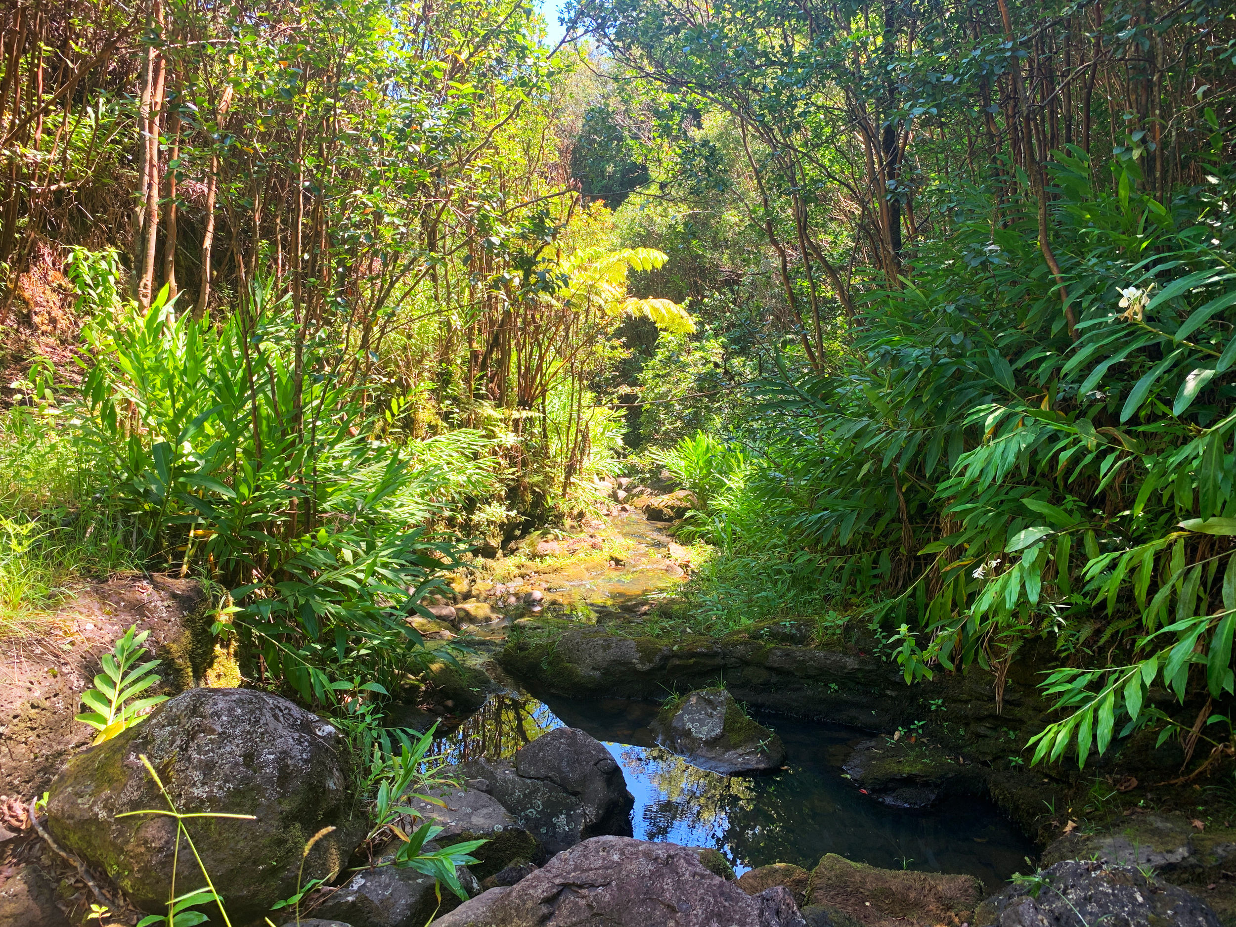
One of my big concerns along this section was where will I get my next water. There had been a good amount of water down in the Honokāne Iki Valley 5 days early but it was bone dry on this day. So I didn’t get to fill up there. What I then expected, but hoped was not true, was that most of the dozens of gullies I would now cross had dry stream beds. I went a long way with minimal water until I came upon an old bridge made with what looked like railroad ties. Just upstream a bit was some murky water. Though it wasn’t my first choice of water to filter, I knew it would work since I really didn’t know when I would find the next flowing stream. I had to downclimb a bit of the vegetated cliff to get to the water source but it was worth it. As it would happen, I wouldn’t find another flowing stream for 2 hours.
I came up to the Awini Cabin next but all the signage around it was not welcoming. I had hoped the cabin had water catchment (like many cabins on the island) and I could access it. But I chose to avoid the cabin altogether since I had filled up my waters 30 minutes earlier. After I navigated around the cabin’s barbed wire fence I was greeted to the best trail on the whole route so far. I took a quick break and soaked in the view. I was getting close to crossing over to the Honoke’a Valley and the trail was visibly unfolded in front of me all the way to an enormous pine tree (or Douglas Fur), which was a great landmark for quite some time on the trail. From this point on, route-finding was never a concern again. From here it feels like you could safely say you were not so much on the Awini Trail but on the Kohala Ditch Trail. Entertainingly, much of it was carved right out of cliffs. And it obviously had seen more recent travel and upkeep.
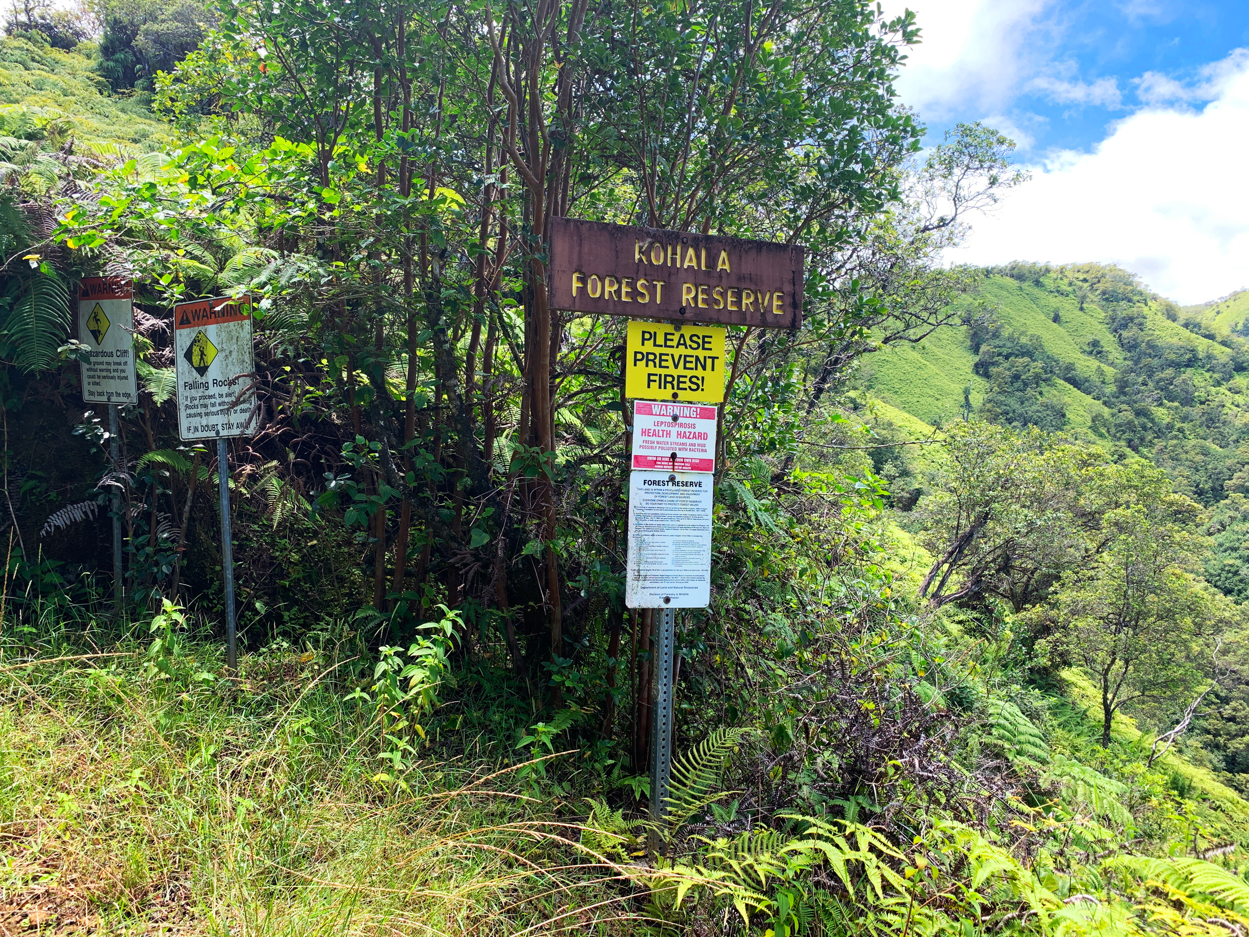
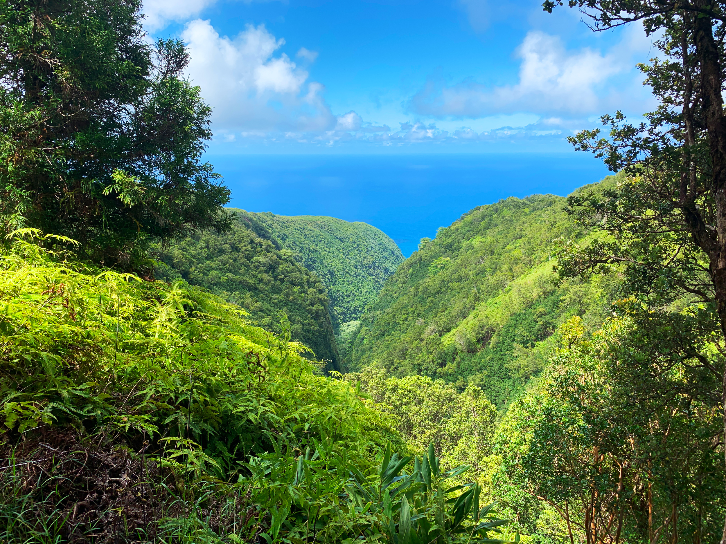
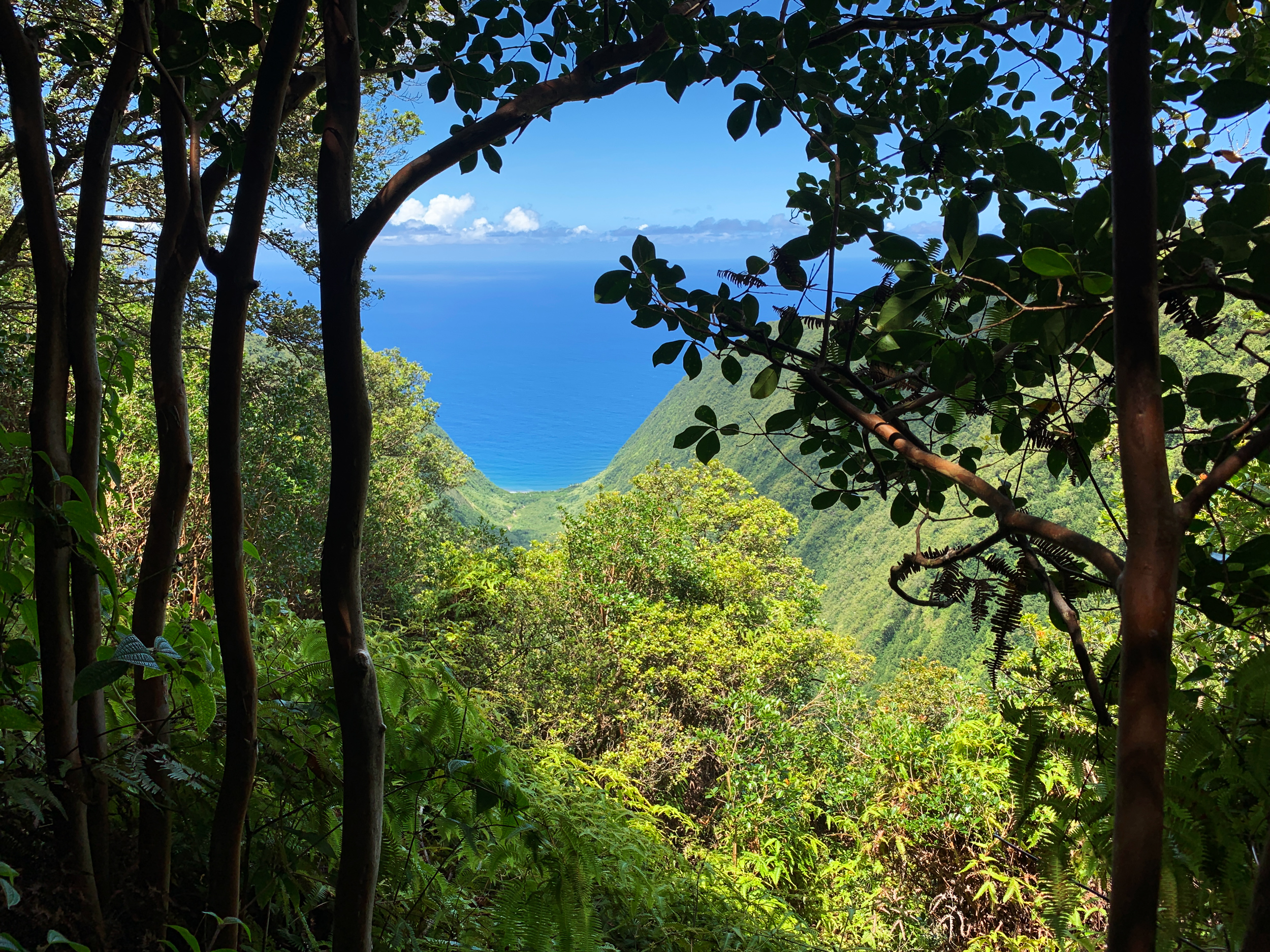
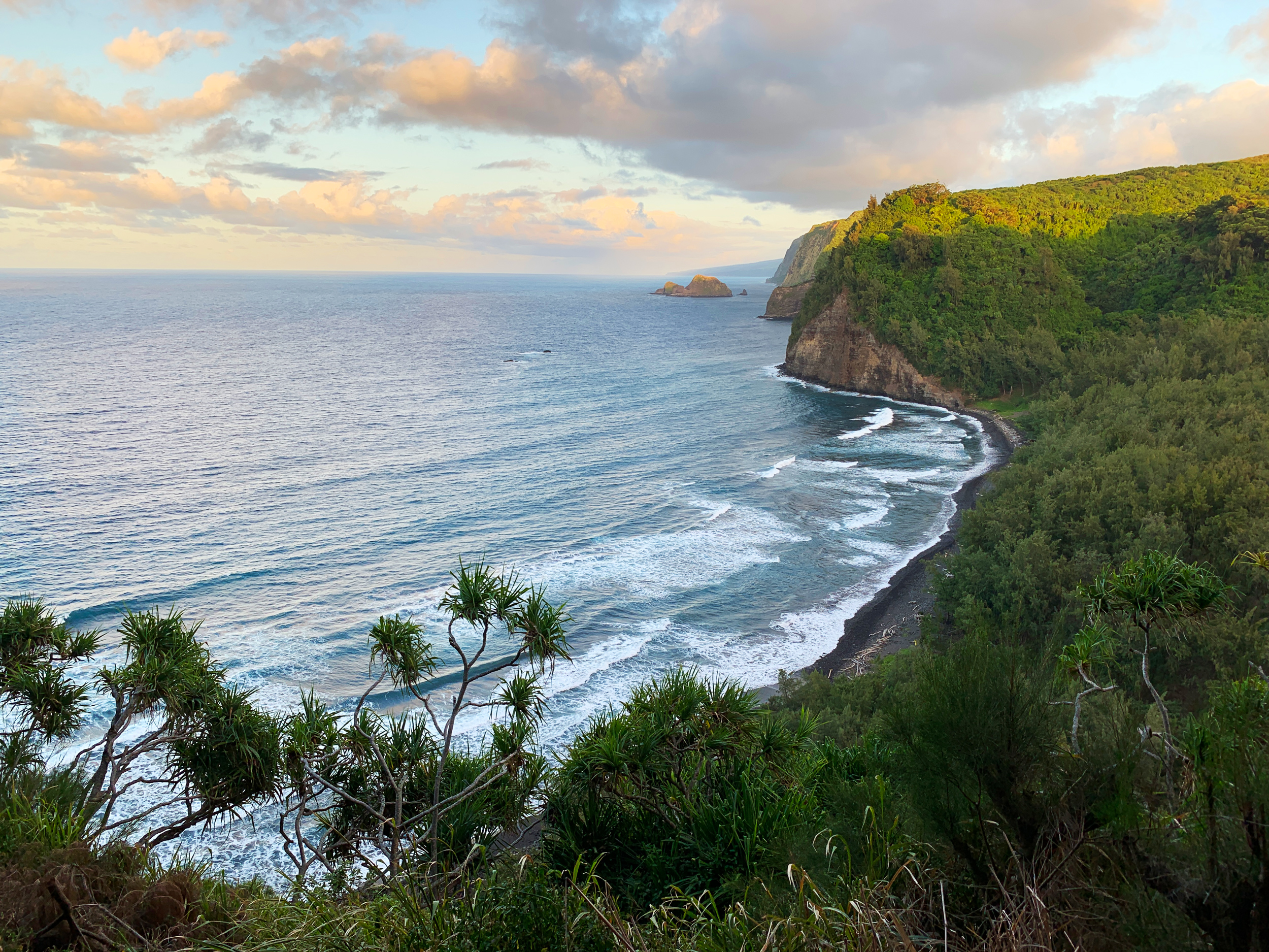
Along the way to the huge tree, I entered quite a few gullies and finally one of them was a stream that was running well. I stopped and made sure my water bottles were full again and then carried on to the Honoke’a Valley crossing deep in the valley a long way up from the beach. After you cross over onto the eastern rim of the Honoke’a Valley you enter into the Kohala Forest Reserve. There are big warnings of dangerous loose cliffs along the trail (like everything up to this point) and drink the water at your own risk. Evidently, all the valleys’ water supplies have a chance of giving you Leptospirosis. Look it up, it ain’t fun. But purify/filter your water and you should avoid issues. The views down the Honoke’a Valley to the skinny little beach at the end were spectacular from up here.
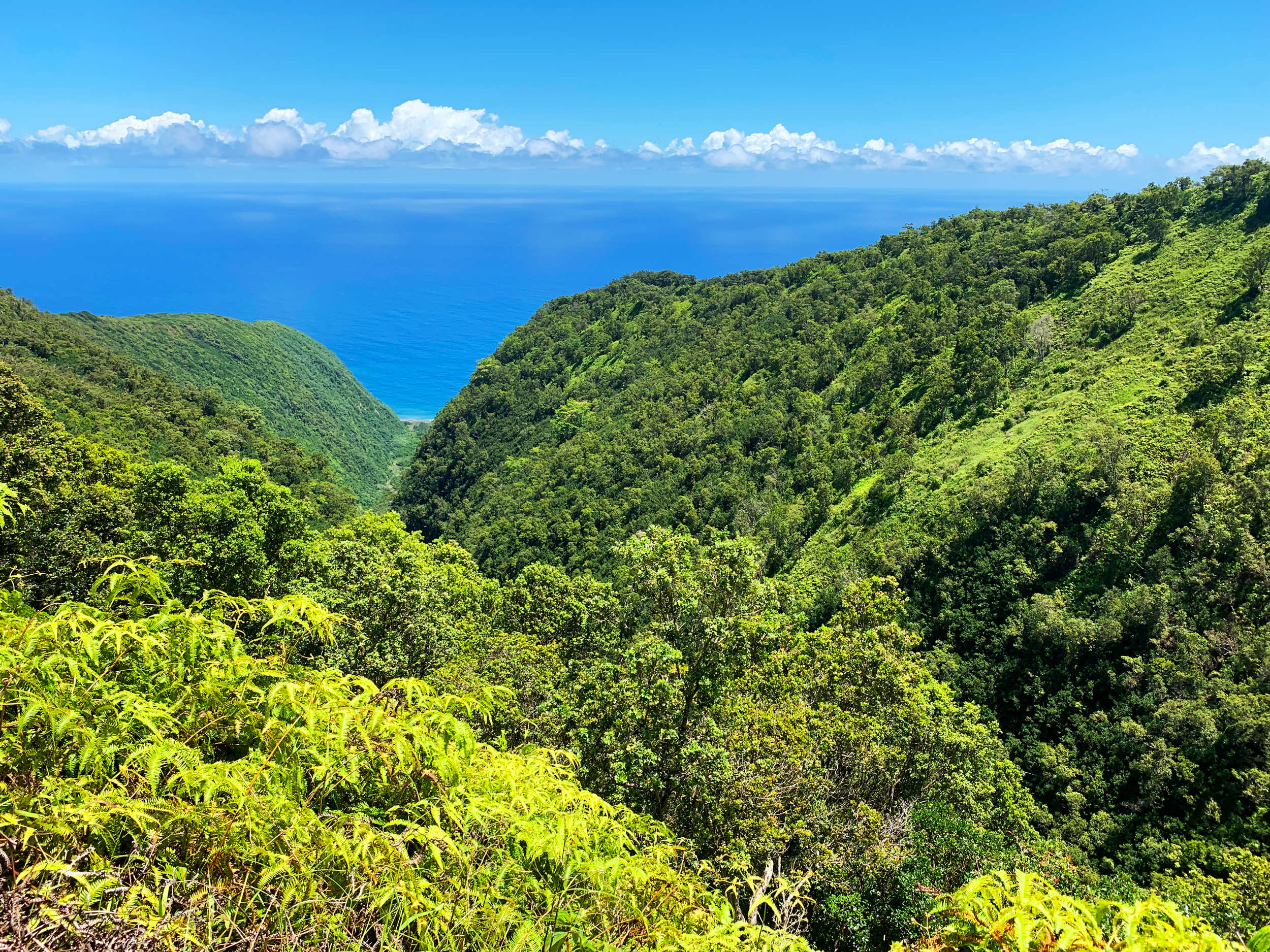
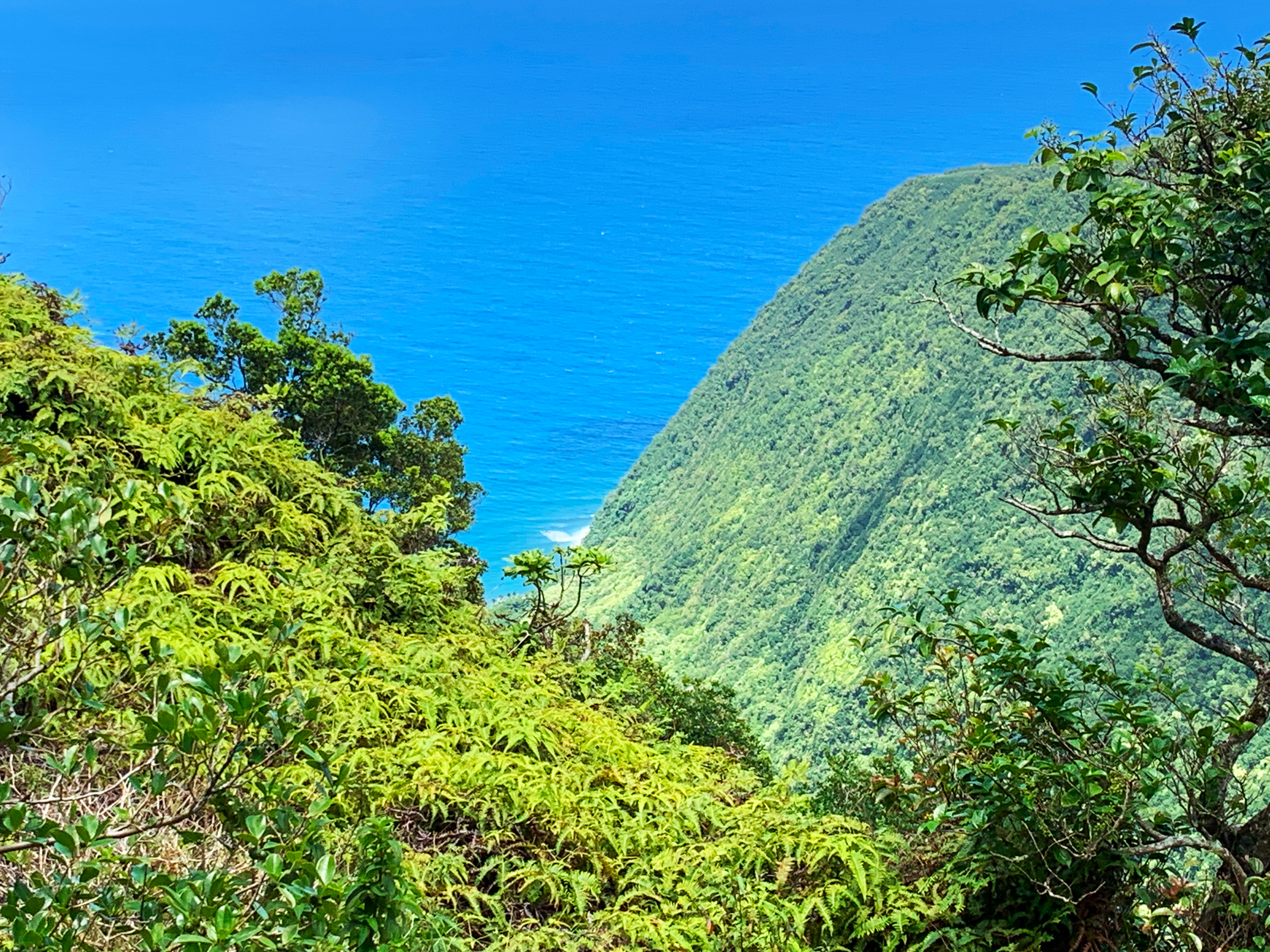
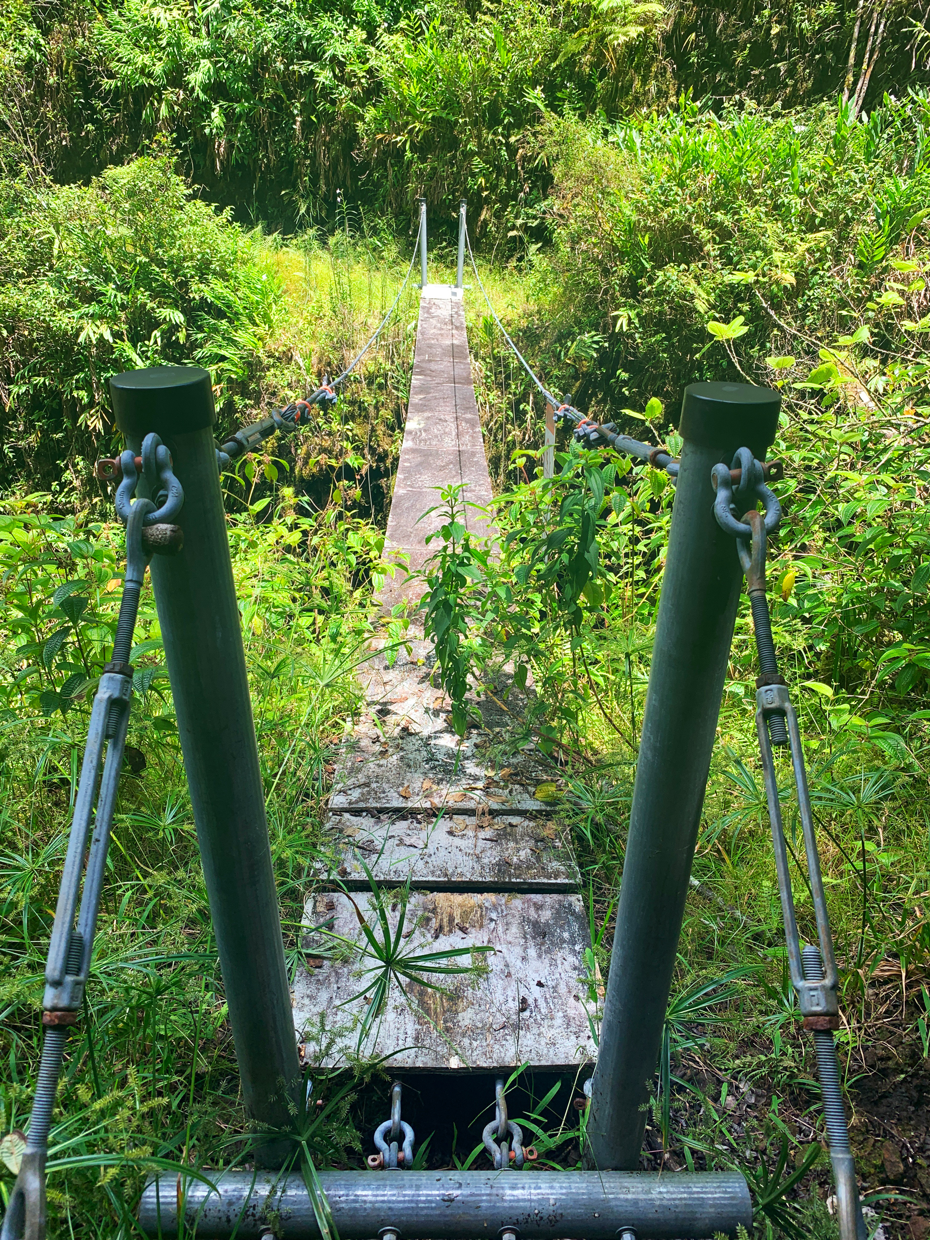
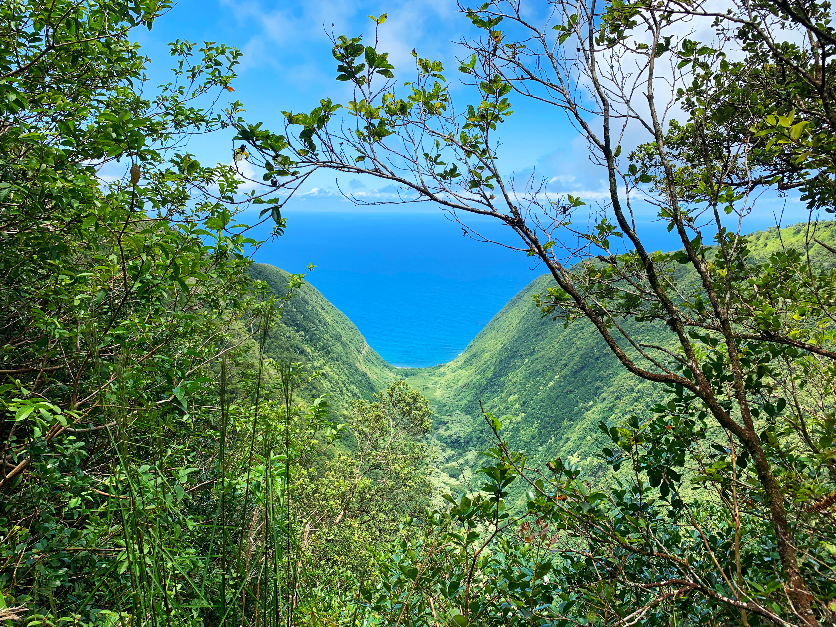
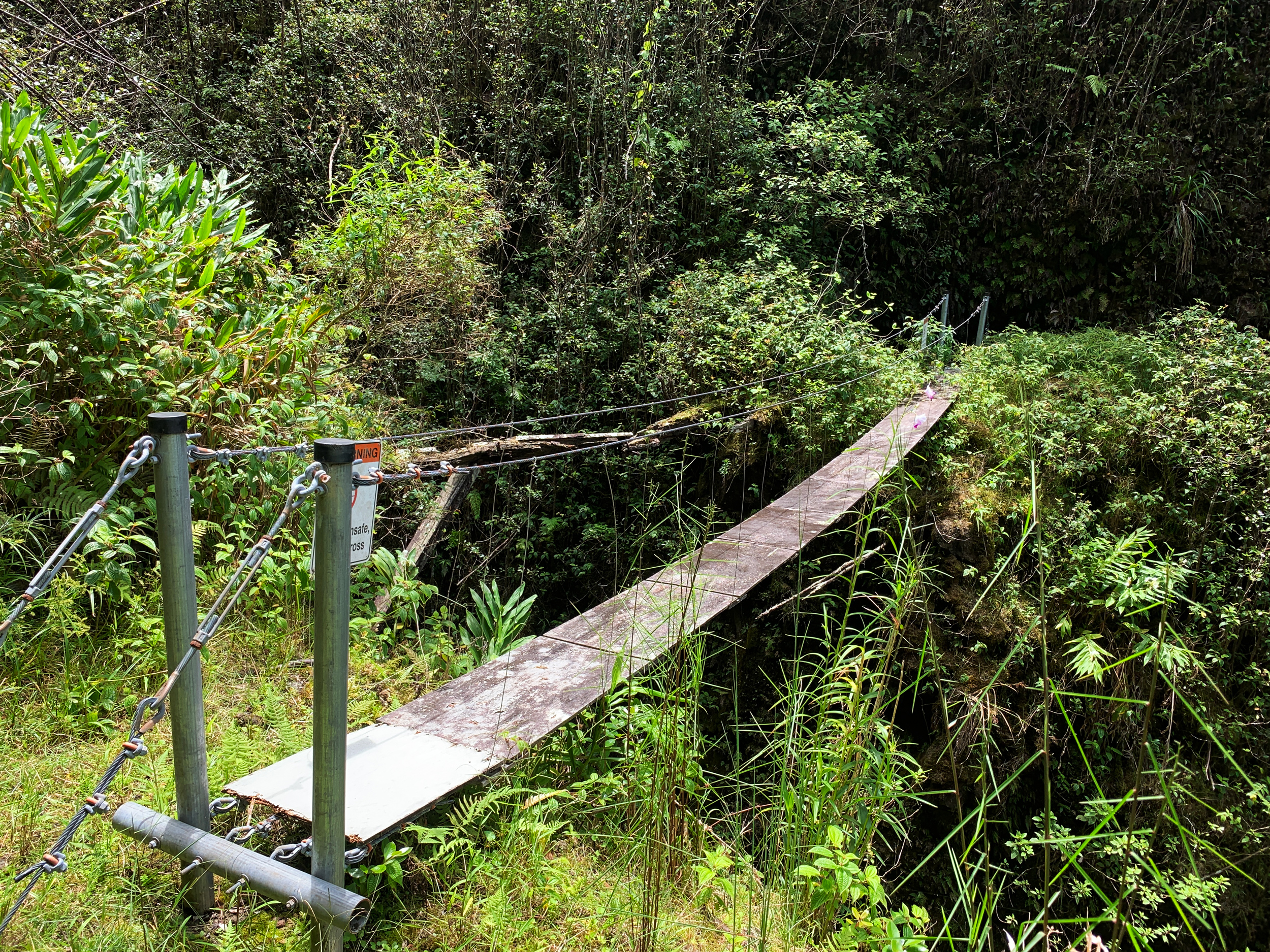
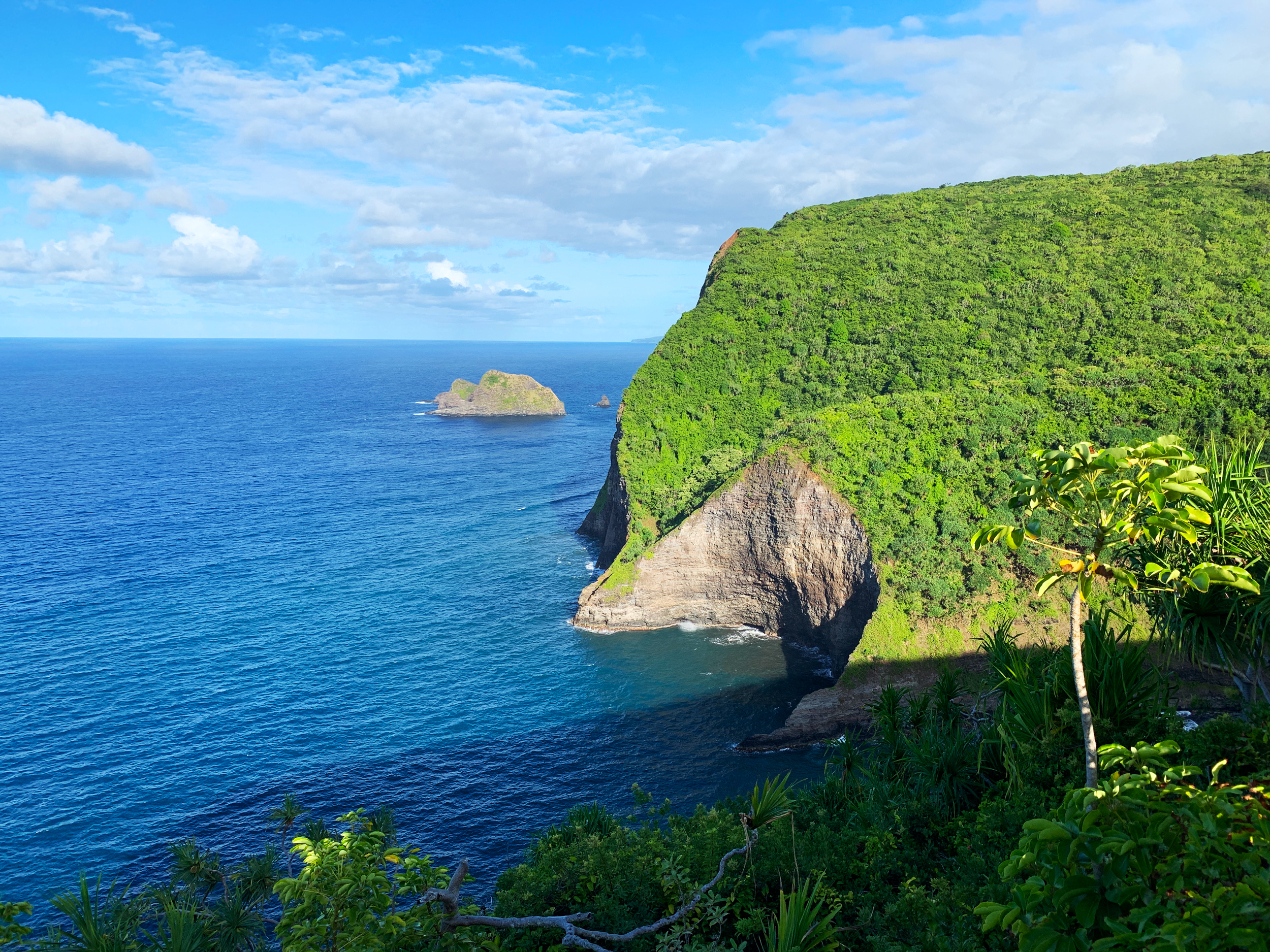
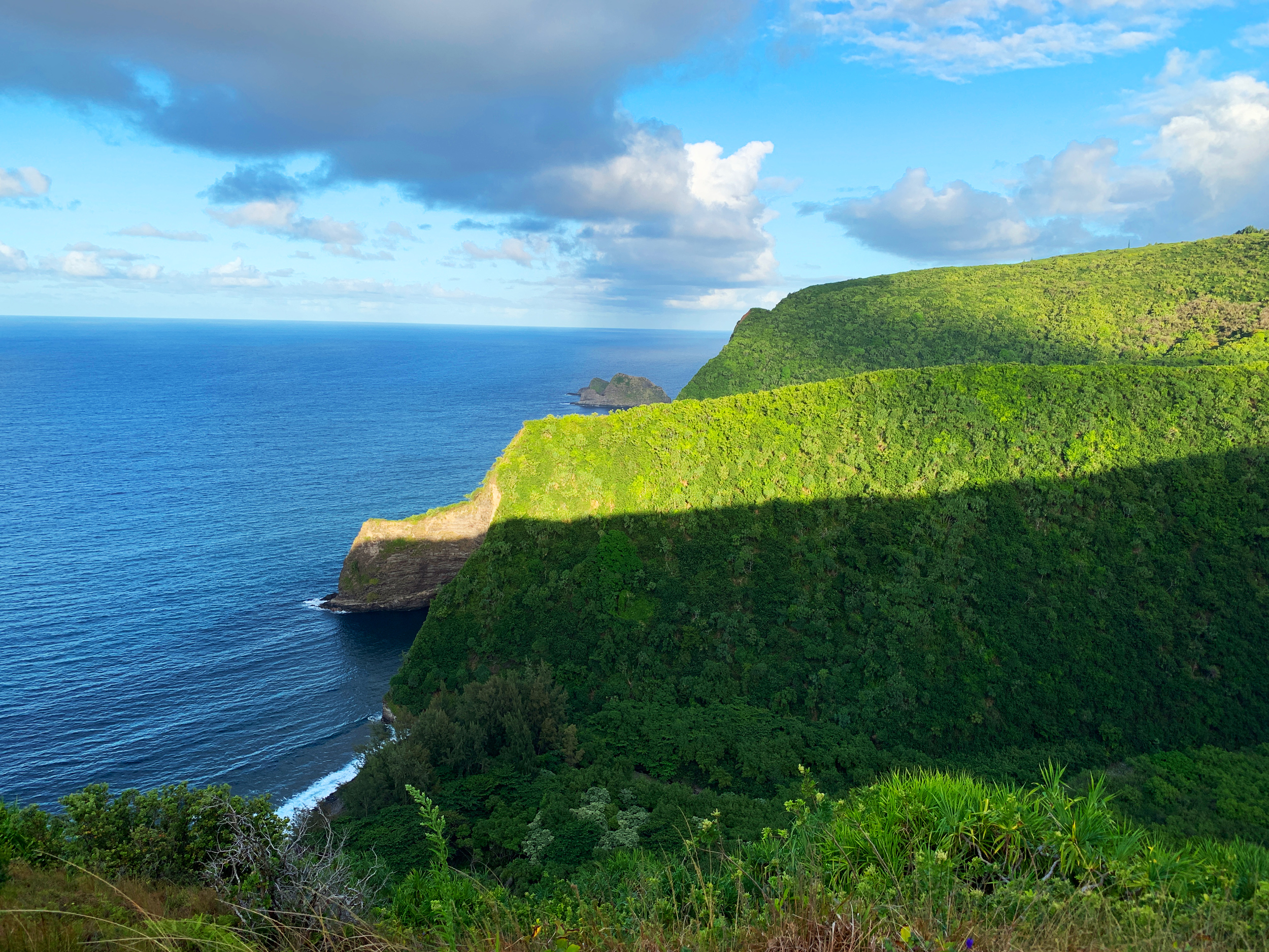
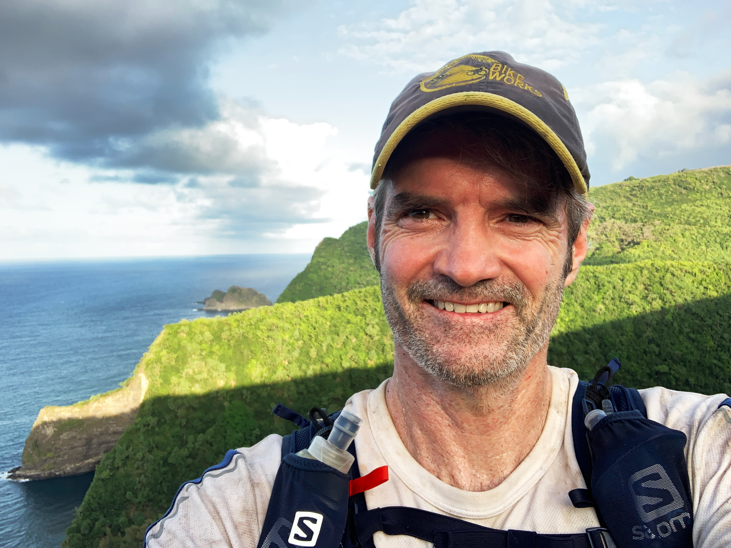
Not too long afterwards I came upon the western rim of the Honopue Valley. This is seriously a majestic valley. The views are incredible and the trail is insane. It was cut right out of the cliff so people could travel to and from work on the Kohala Ditch Trail back in the early 1900s. In fact, there was a sneaky little hole in the mountain along the trail with an entrance to the Kohala Ditch itself. You can step right into the ditch and see how it was built right into this mountain (sorry I was in a rush at this point and took no footage of it). Many sections along this part of the trail are like a 6-foot wide garden path with a thousand-foot drop along one edge and a cliff wall on the other. I kept following the path to my final destination for the day – the Honopue Suspension Bridge. Now, this structure is entertaining, to say the least. The handrail cables look super sturdy, the mounting posts on each side of the bridge look exceptionally secured, but the cables holding the floorboards are not viewable and the floorboards themselves are suspect. And when you walk across it the cables under the floorboards do some unnatural squeaking. But you do feel that if the floorboard or floor cables gave out the handrail cables would completely hold you. Would I let my 9-year-olds cross it? Not without a harness and a daisy-chain clipped into the handrail. Otherwise, the bridge really is solid – haaa. But in all seriousness, I would like to thank all those involved in putting this new bridge up in 2010. When you look at the old broken bridge next to this bridge (you can see it in the video below), you realize this is truly a safer way to cross an impassable area otherwise.
In Conclusion
Wrapping up this adventure.
So by the time I crossed the bridge I was 8.5 hours into this hike and I, unfortunately, had to turn around and head back to my truck at the Pololu Lookout. It was a little after 1 pm and I knew I had to hustle to give myself a margin of error in case I got lost on the way back. I felt confident if I could make it to the Honokāne Iki Valley eastern rim before dark I could comfortably make the rest of the way by headlamp. Evidently, I had nothing to worry about since my memory of the trail was solid and I jogged many of the downhill sections (where I could see my footing). I managed to make it to the top of Honokāne Iki 2:45 minutes later and had plenty of time to spare to fight my way back down to the valley floor and make it back to the Pololu Lookout before sunset.
Would I recommend this hike to everyone? Well… not really. Beyond the fitness, you have to really want to get way back up into the valleys. Almost all the trail is overgrown and takes a lot of effort to travel through. The experience and views are spectacular but you will have to seriously earn them. And if you are making it a day hike and plan to go far you really need to be sure you have the gear, food, and knowledge of where all the water is in case you wind up getting stuck up there overnight. I was fully prepared to spend the night out there – albeit somewhat crudely. I had even left with the intention I might purposely spend the night. But ultimately, on this day, it made sense to go home. On the next trip though I’ll make it down to the Honopue Beach and spend the night. But that will be a story for another day. Until then…
What you need to know about trail finding on the Awini and Kohala Ditch Trails:
All maps I have found from Google, Bing, and my goto Gaiagps.com have the trail marked wrong. Very wrong in some locations. I’ve found that most trails on the island are incorrect when shown by almost all apps unless (like in the case of Gaiagps) someone has recorded the GPS on the trail itself and made it public. And even then in a covered forest, the GPS readings are mostly wrong. So ultimately your GPS app is a tool that will help out from time to time in a clearing. But you have to rely on your own senses and common sense to really find the trails in this neck of the woods. So if you have never been out there, expect to go off-trail quite a bit. And you will often feel that you are bushwacking through pig trails which is true. It’s really only the pigs that travel these trails nowadays and everything is heavily overgrown. Consider that when estimating how much time your hike will take. And turn around often and take a mental snapshot of the trail you have just traveled so when you come back it will feel familiar.
Finally, this is not about trail finding but is important to know: since you are often on pig trails you can guess you are going to come across a few pigs. Every time I’m out there I’ve seen or heard dozens of pigs and I’ve had at least 1 head to head with a boar each time. Back off out of their line of sight slowly and then start making a pile of noise. This typically allows them to leave without you as an immediate threat.
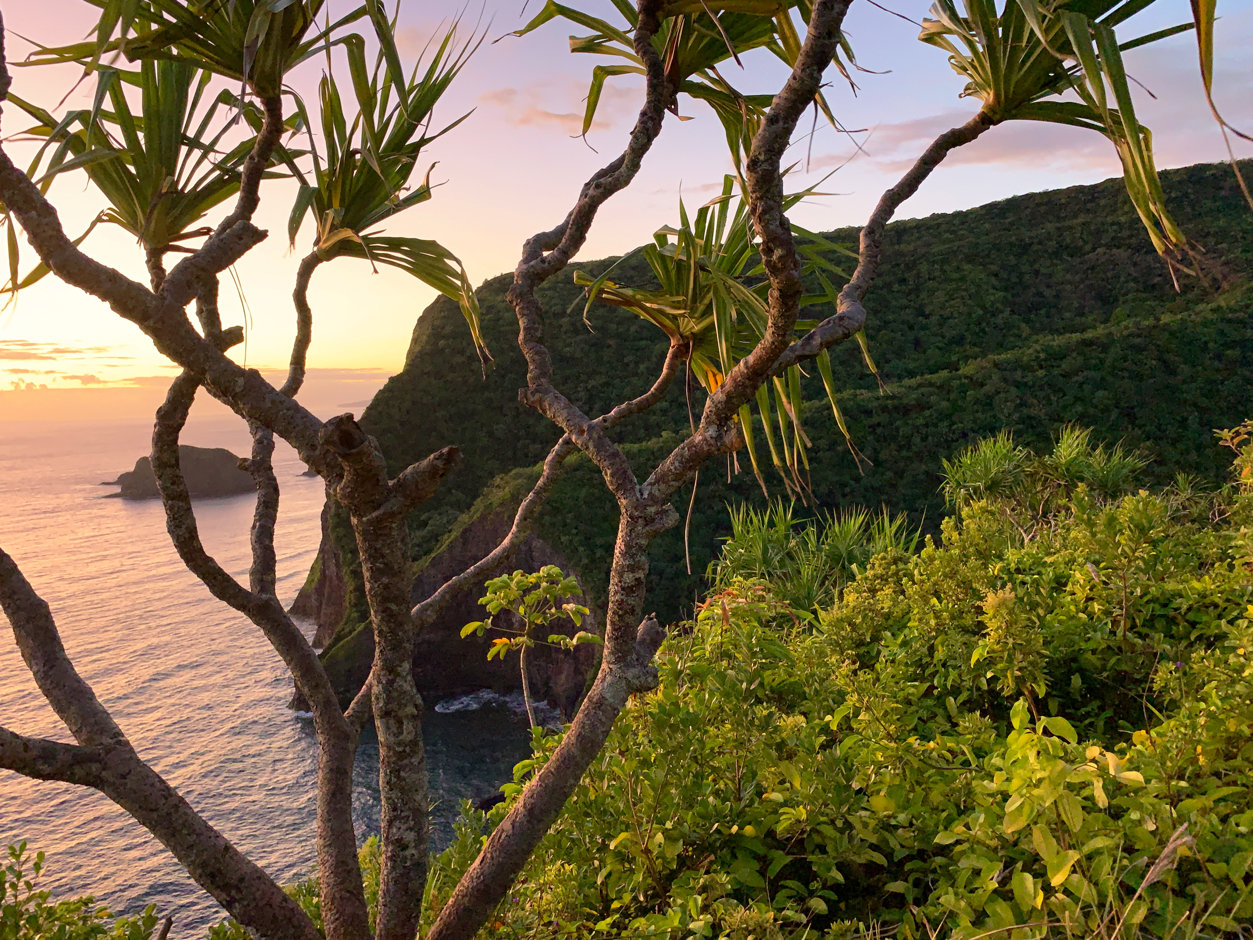
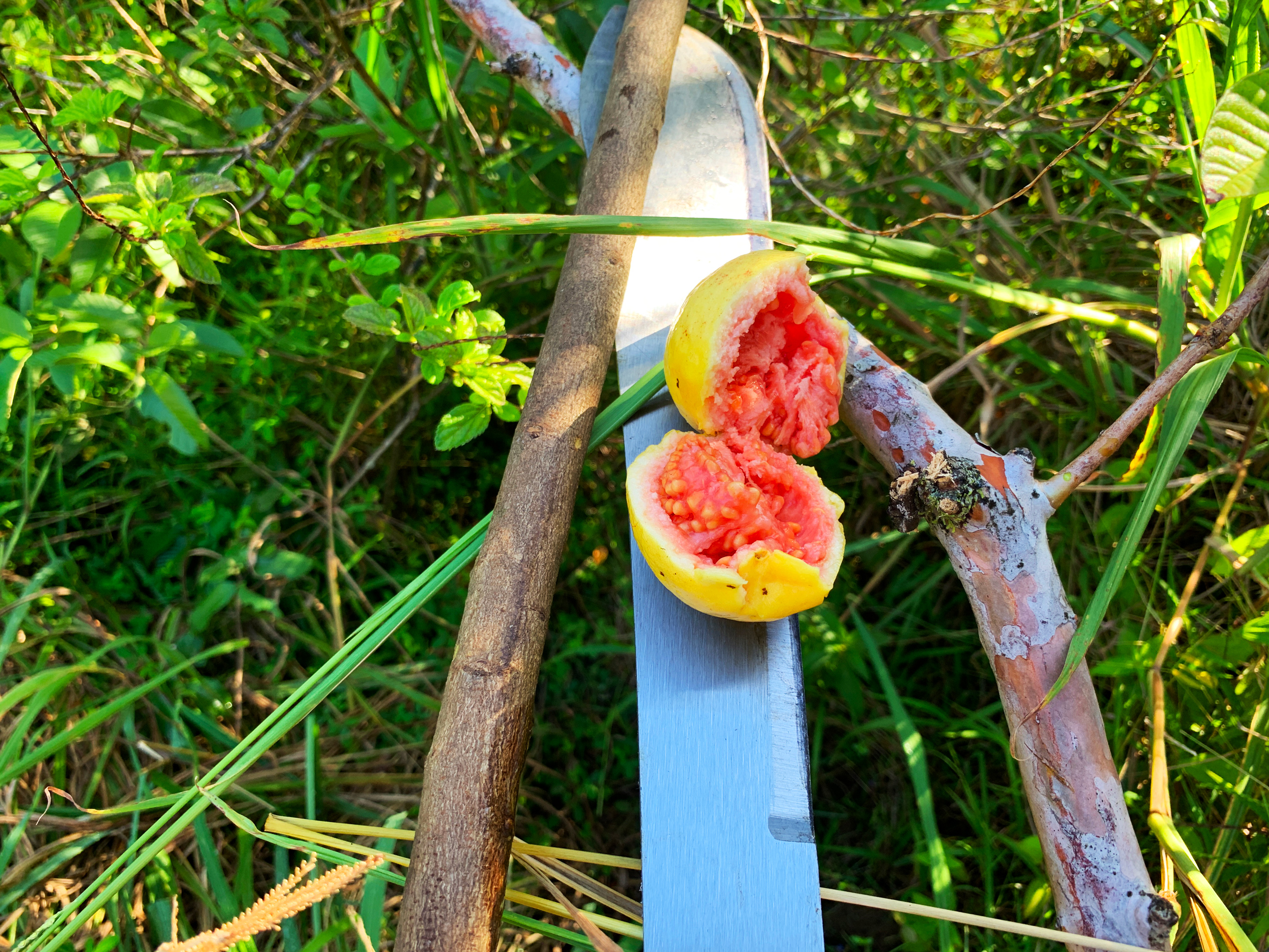
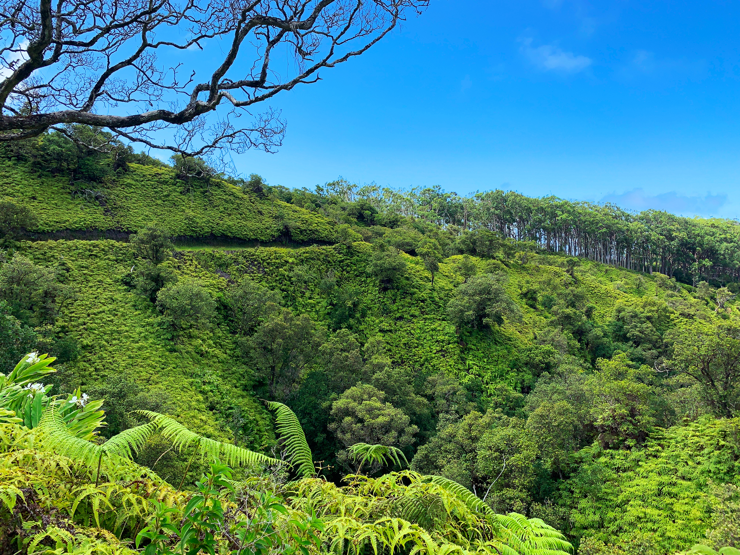
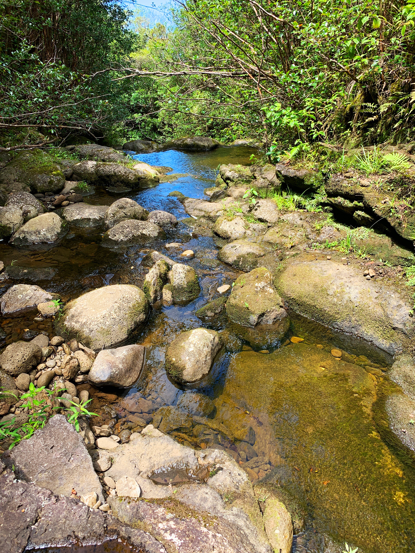
Pololu to Honopue Suspension Bridge – Out and Back Extra Images
Here are a few more shots to whet your appetite.
Related posts
-
-

Hamakua Challenge Training – Waipi’o to Waimanu – Out And Back
August 19, 2019
-

6 comments
June Mitton September 6, 2019 at 4:14 am
I really enjoyed reading about this adventure. Thank you for sharing. I am amazed to see and read about your trips. Keep on writing too. Another of your talents for sure.
Warren Hollinger September 6, 2019 at 7:11 am
Thanks, June. I appreciate that. I’m glad you are enjoying the stories.
Brendan Gomera September 24, 2019 at 5:46 pm
Nice read on the awini trail….looking forward to getting in there again…
Warren Hollinger September 24, 2019 at 6:23 pm
Thanks, Brendan. It is a beautiful place to be. I’ll likely write up a couple more articles on the area.
Miranda July 25, 2020 at 10:33 am
Very cool! I’m so amazed at how these trails are built and how they still seem to stay somewhat in tact with very little foot traffic and upkeep. And that suspension bridge… WOW!
Warren Hollinger July 25, 2020 at 1:39 pm
Thanks, Miranda. There is some amazing history behind the making of the trails out there that is well worth following up on. The building of the Kohala Ditch back in the early 1900s and the centuries of Hawaiian life back in those valleys makes for some great research and discovery.