
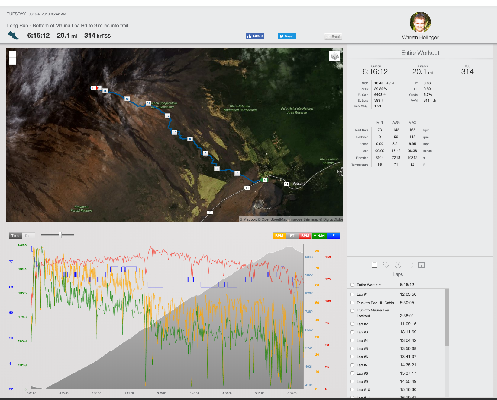
This run has changed multiple times over the last few weeks as I determined how well I would recover from each previous “Long” Run. Initially, it had been set to be the whole Mauna Loa Trail and back. Basically a 40-mile round trip from 6,700 feet to the 13,678-foot summit of Mauna Loa and back. It’s been on my hit list for years but, unfortunately, it was too big of a run to slip in 12 days before the Sea to Summit push. Ultimately what was most important was to cover the ground I had not covered which was the Middle Section of the planned Sea to Summit run. I had done the Bottom Section (see article here) which was the first 22 miles from the ocean to what I was calling the top of Kilauea (the bottom of the Mauna Loa Strip Road). I had also done the Top Section (see article here) which was from just above the Red Hill Cabin to the summit and back down to the Mauna Loa Observatory. So this middle section was now defined as the bottom of the Mauna Loa Strip Road to a mile past the Red Hill Cabin. It was basically 19 miles from 4,000 feet to 10,300 feet. The tricky part was I needed to get 19 miles back to my truck. And, though on paper, this reads similar to the 40 miles out and back of the Mauna Loa Trail, this workout would be much easier to do. I didn’t have to deal with how hard and slow it would have been above 10,000 feet and most importantly I would walk the whole 19 miles back. Had I done the 40-mile trail out and back, I would have done it to have the fastest time (13 hours, 9 minutes), and run most of it back. And this would have caused so much tissue damage I would never have recovered in 12 days. So this Middle Section was now defined and would be the last long run before the Big Day.
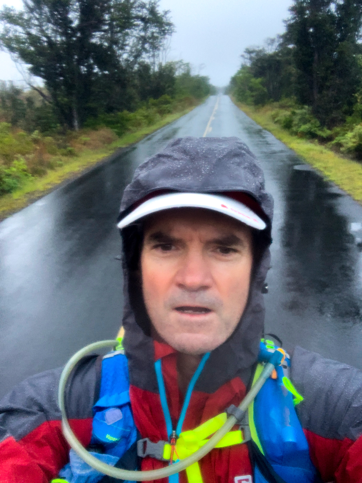
A 2 am wake-up has me loaded in the truck and heading for Volcano Village at 3 am. A little over 2 hours later I am staring out into the darkness at the bottom of the Mauna Loa Strip Road, watching the pouring rain. It is a rain forest at 4,000 feet so obviously, it is going to rain there a good amount of the time. But I was a bit bummed about it at first. Then, a few minutes later, I figure it winds up being a good excuse to try out my rain gear so I pull it out of the running pack. I stuff another heavier long-sleeve shirt into a ziplock bag and load that inside my pack. I wait for first light and stow my headlamp into the pack. And then there is nothing left to do but get out into the rain and head upwards.Relive ‘Mauna Loa Strip Road to Above Red Hill Cabin’
You would think that living on the Big Island and doing these adventures I would run into a fair number of rainy days. But honestly not that often. And it is rare to be going out for 10 to 12 hours and expect to be wet for the entire time (unless you are in the Hamakua backcountry). But it was going to be one of those days. And this all worked out well because I was able to evaluate what gear was working well and what was failing in these conditions. This was really important since on the actual Sea to Summit day, moving through the lower elevations from 0 to 9,000 feet there was a high potential of being wet for most of it. And then once you take all your wet gear up above 9,000 feet, you better be sure it dries or performs well wet. And, above 12,000 feet where it often gets to near freezing will the gear still be working as expected? Honestly, this is part of what really makes this adventure so interesting to me: I get close to running my way through 10 of the world’s 14 climate zones in one 60-mile day. Where else in the world do you get to do something like that? But with that comes the issue of how to have the right gear for all the conditions. Overall this run was there to point out any weak links in my gear. And the almost all-day rain was the best thing that could have happened.
The Mauna Loa Strip Road winds up a beautiful landscape for 11.5 miles. It is consistently raining but the view and music from my headphones keep me distracted. I notice around halfway up this road that my speed has slowed down ever so gradually. The hill isn’t that much steeper (changed from 4% to 6% grade) but at this point, I’m over a mile (5280 feet) above sea level, and typically this is when I feel a real change in effort. When going from 0 to almost 14,000 feet there are a few elevations that wake me up to the fact that I’m not at sea level anymore. For me it seems at 5,000, 10,000 and 13,000, I notice a perceivable increase in difficulty. Of course, it is slowly getting more difficult as I ascend but I tend to wake up to it at certain elevations. So now my 13 min miles have turned into almost 15 min miles while the effort remains the same, 144bpm (beats per minute) heart rate. I’ve gotten used to this phenomenon and know how to push my ego out of the way when it hounds me that I am going soooo slooowww. No part of a 55-mile hill is to be rushed – if you want to complete it. At 2:37 into the run, I reach the Mauna Loa Lookout at an average pace of 14:03 pace after gaining 2,739 feet.
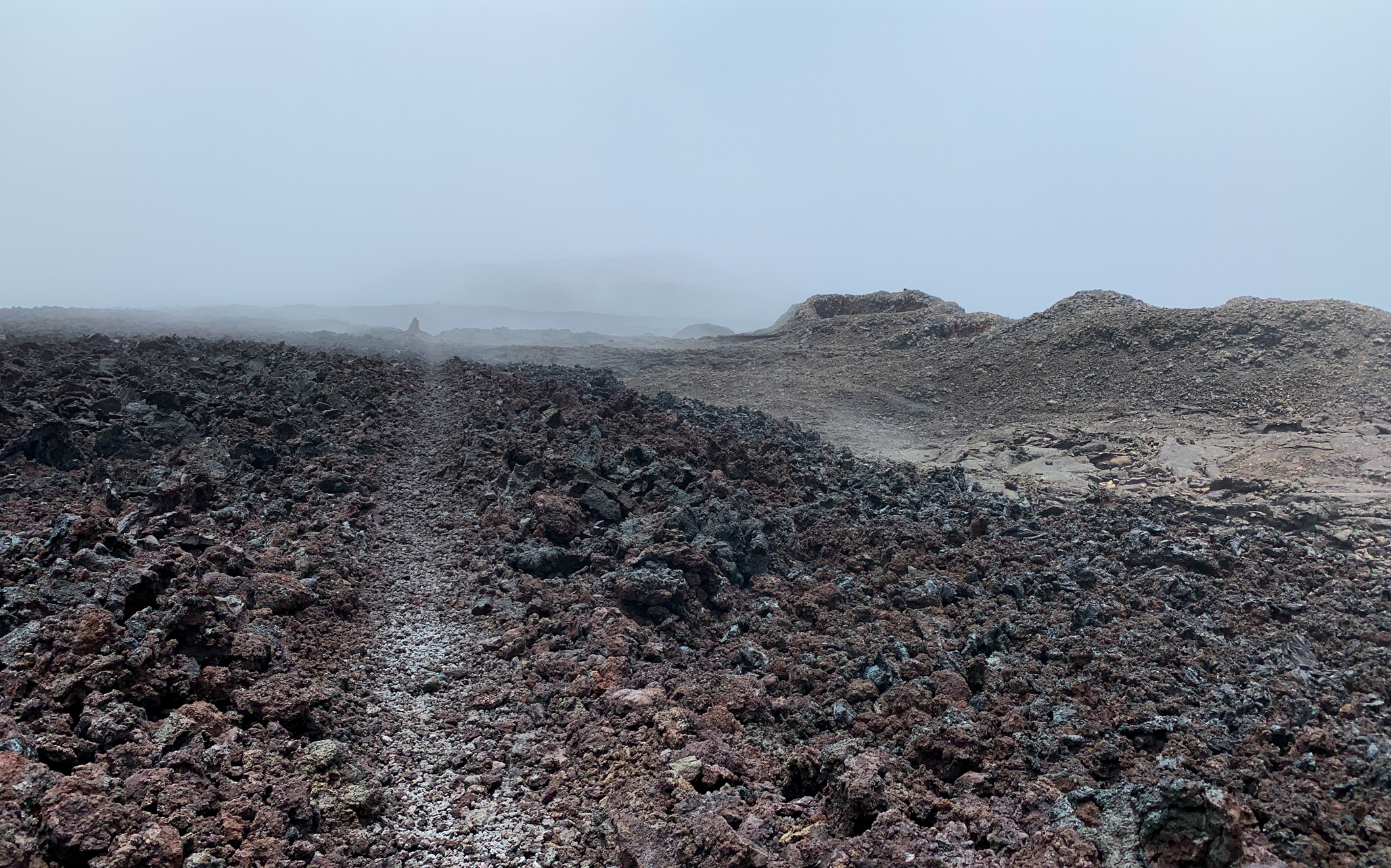
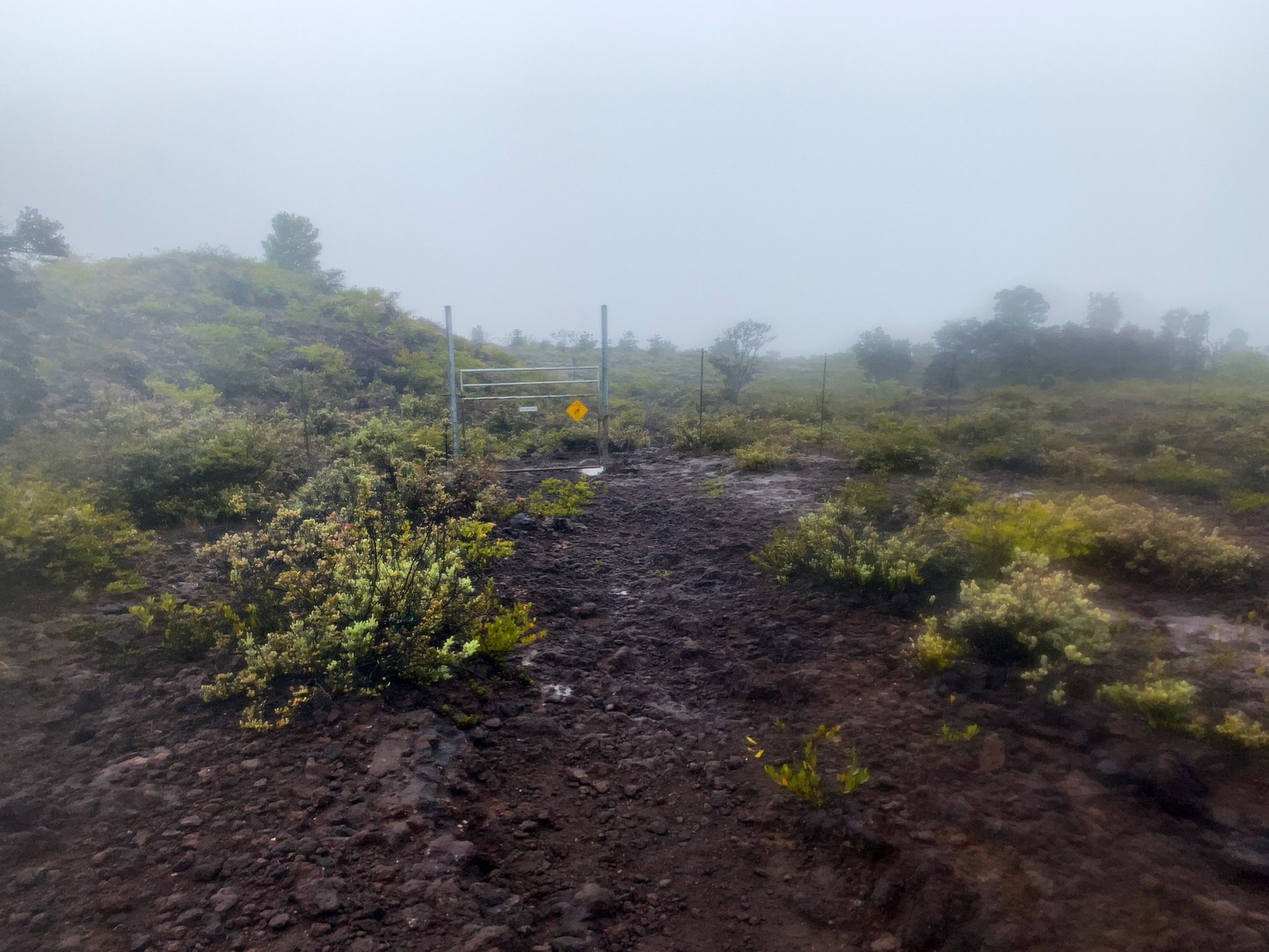
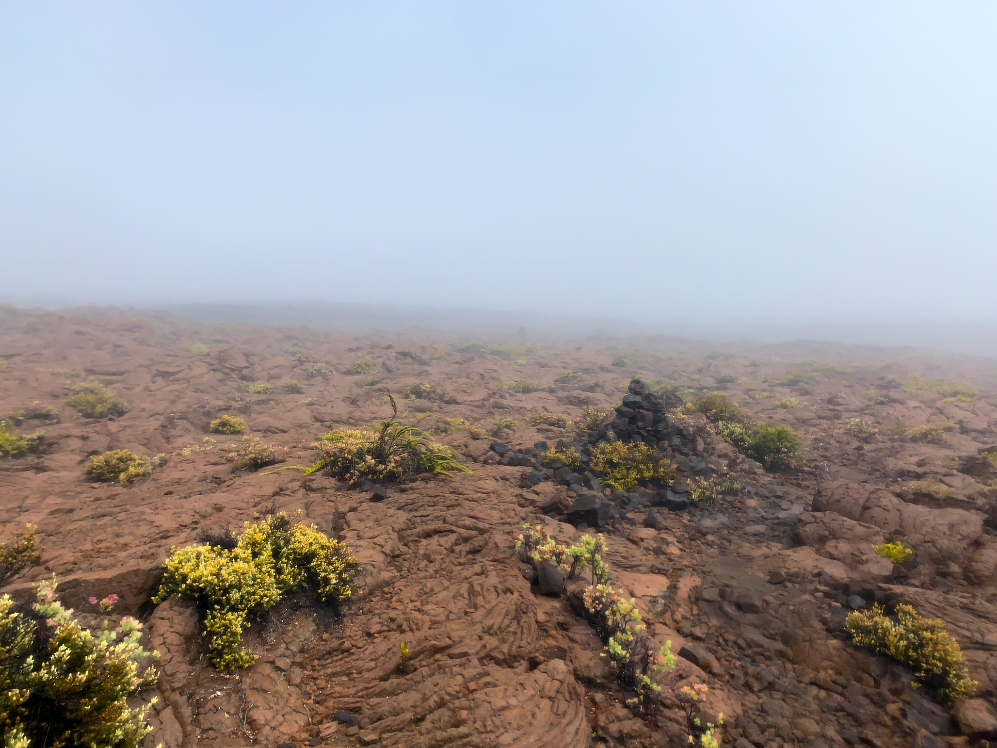
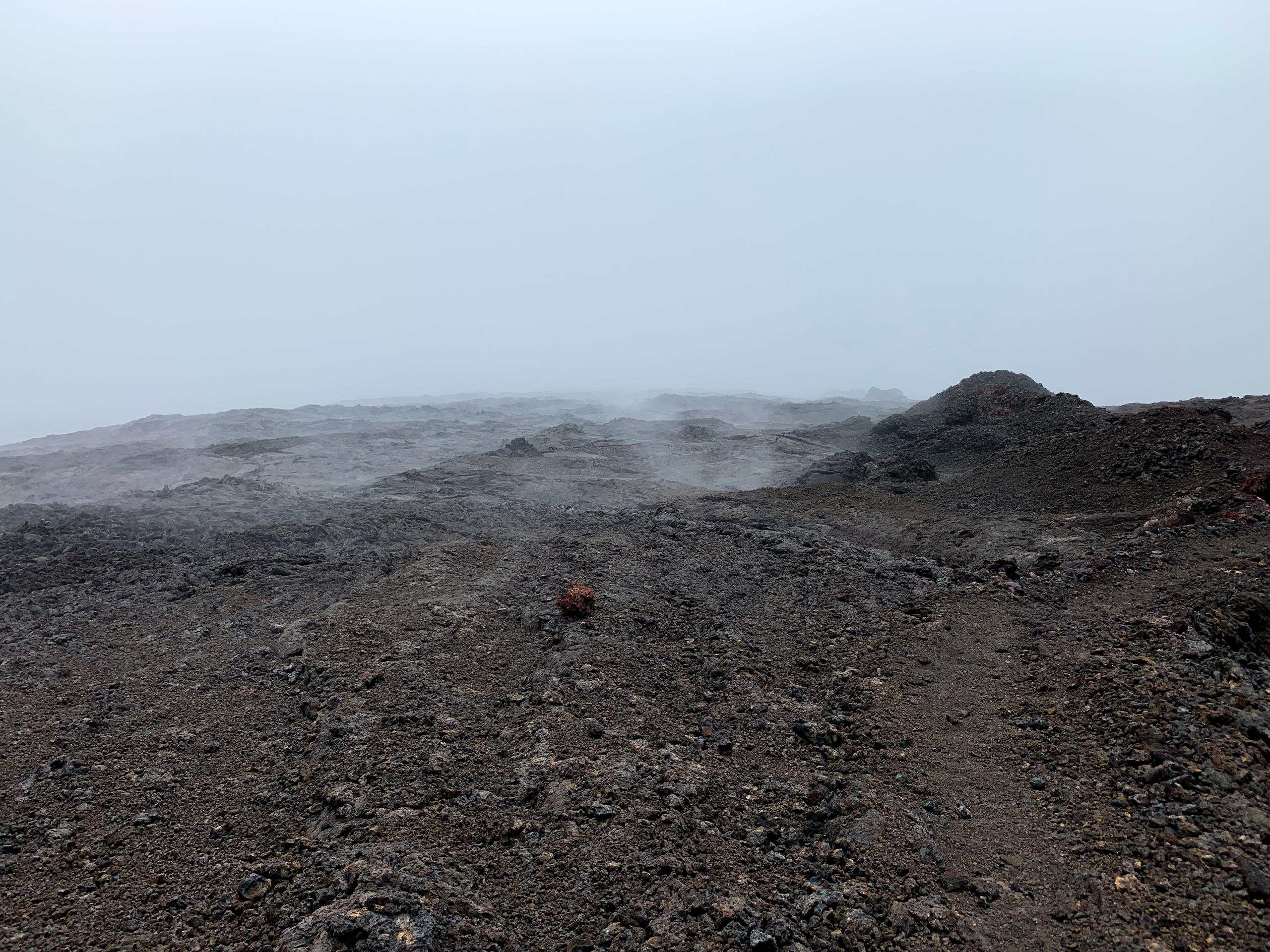
I still feel fresh so I leave the road and head onto the trail. The route finding for the first 3/4 of a mile is quite easy even in a dense fog. But once you pass through a gate and into the more open lava fields you really need to keep your head up and on a swivel because the trail can head in any direction, including down. As a climber, you spend years developing a sense of knowing where the line of least resistance is and following it no matter if it is a vertical cliff or a 10-mile approach to a vertical cliff. But this trail, at least in a fog, does not appear to follow the line of least resistance mantra. And my pace slows down to almost 20 min/mile trying to follow this trail while also having the trail’s grade increase to over 9%. This mountain is supposed to be “Long” mountain, not “Steep” mountain. And in the context of our other volcanoes, it really isn’t that steep. But try and run/jog/walk briskly up a 9% grade above 7,000 feet and you’ll swear it “feels” steep.
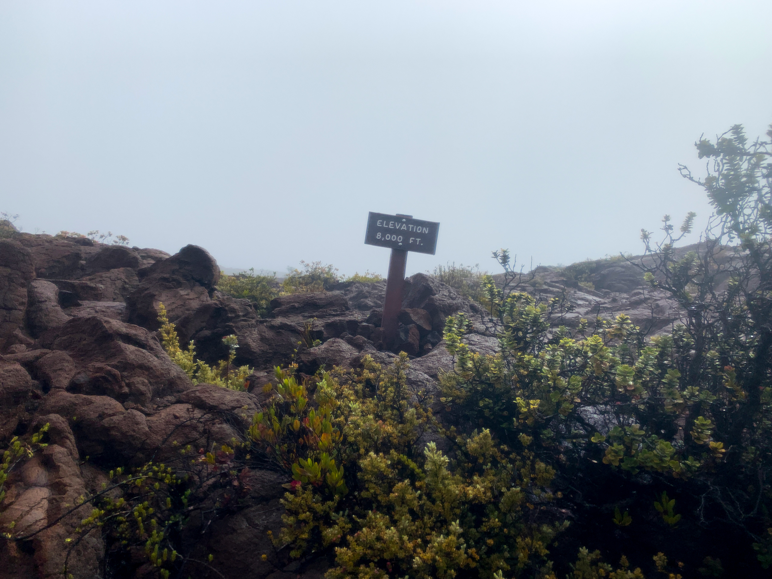
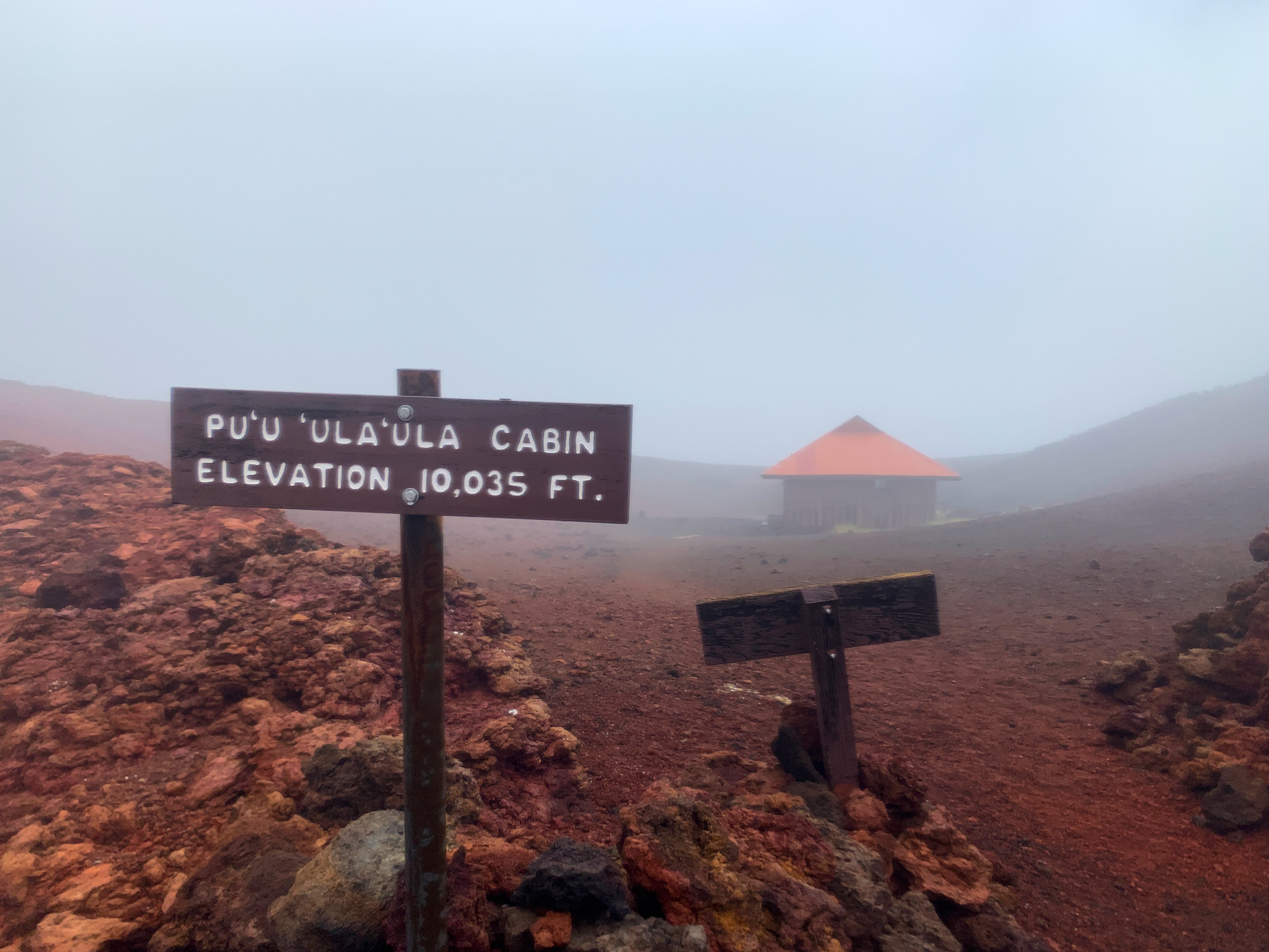
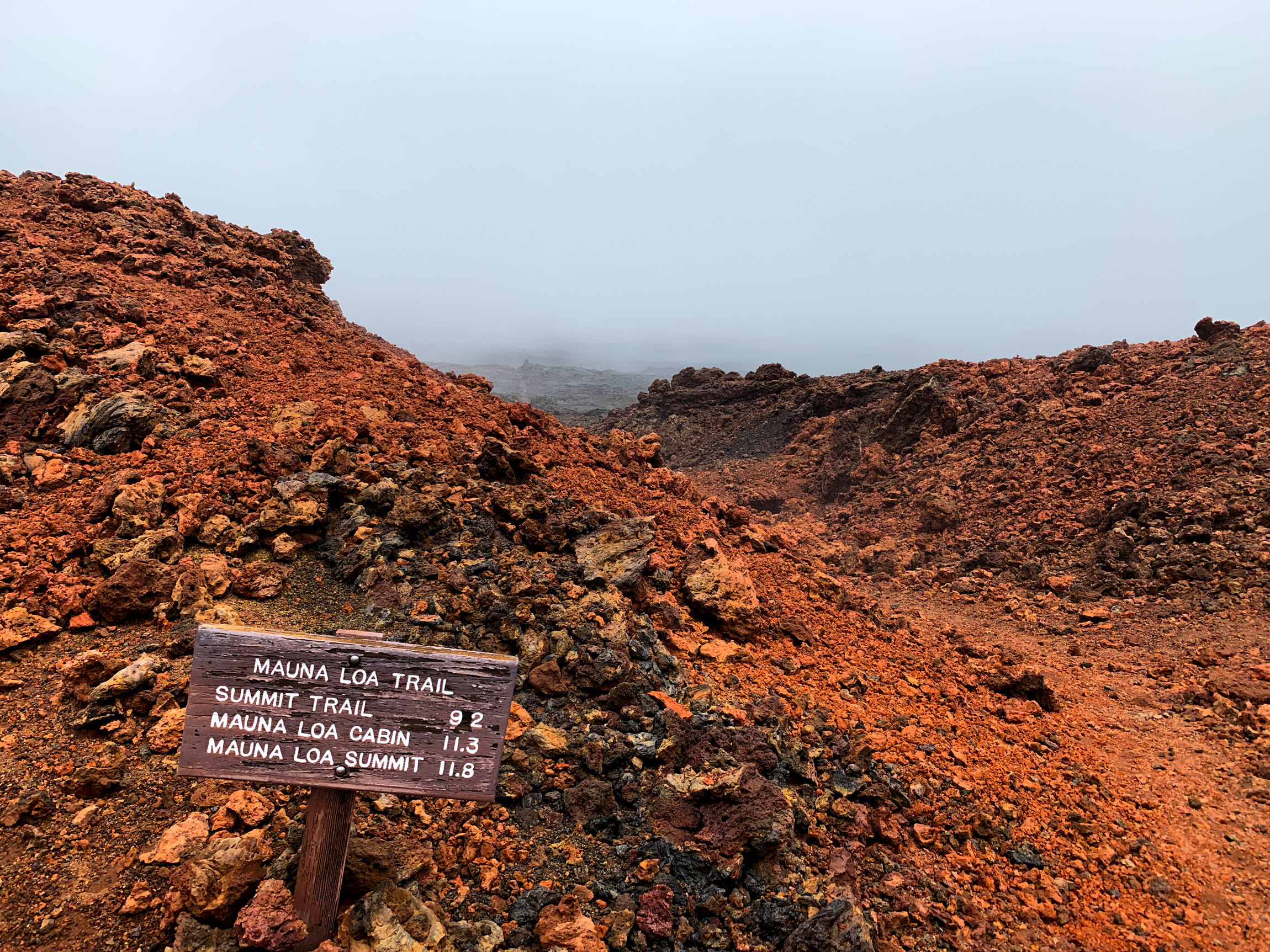
At just over 8,000 feet you see the last tree. Unfortunately, it looks dead and is a reminder of how hard it is to live up this high. By 9000 feet I’m entering Mauna Loa’s alpine zone and vegetation is scarce and the lava is getting that raw fresh flow feel. By 5:30 into the run, I’ve reached 10,000 feet and the Red Hill Cabin. My average pace has slowed to 17:48 minutes per mile, my average Heart rate has bumped up to 146bpm. I jog past the cabin and keep heading up the trail. There will be plenty of time to explore on the way down. A mile later my Gaia app tells me I have reached the GPS location of my low point on the Upper Section Workout. I stop and look around. The view is surreal – like I’m on another planet. I take out my inReach satellite communication device and send a text out saying I’ve reached as high as I am going today and heading down. I find out later they received my message and the satellite tracking system worked well. I now also take stock of where my head is at. I’m 19.2 miles into this workout and I feel great. I look up the trail and feel confident I have the energy to cover the last 11 miles to the summit. I also feel the gear I have on would be sufficient to make it there, and if I was stranded up high for the night, would keep me alive. I spin around and head back down to the cabin happy in the knowledge the training has been going well enough to feel this good 6 hours and 6400 feet into the day.
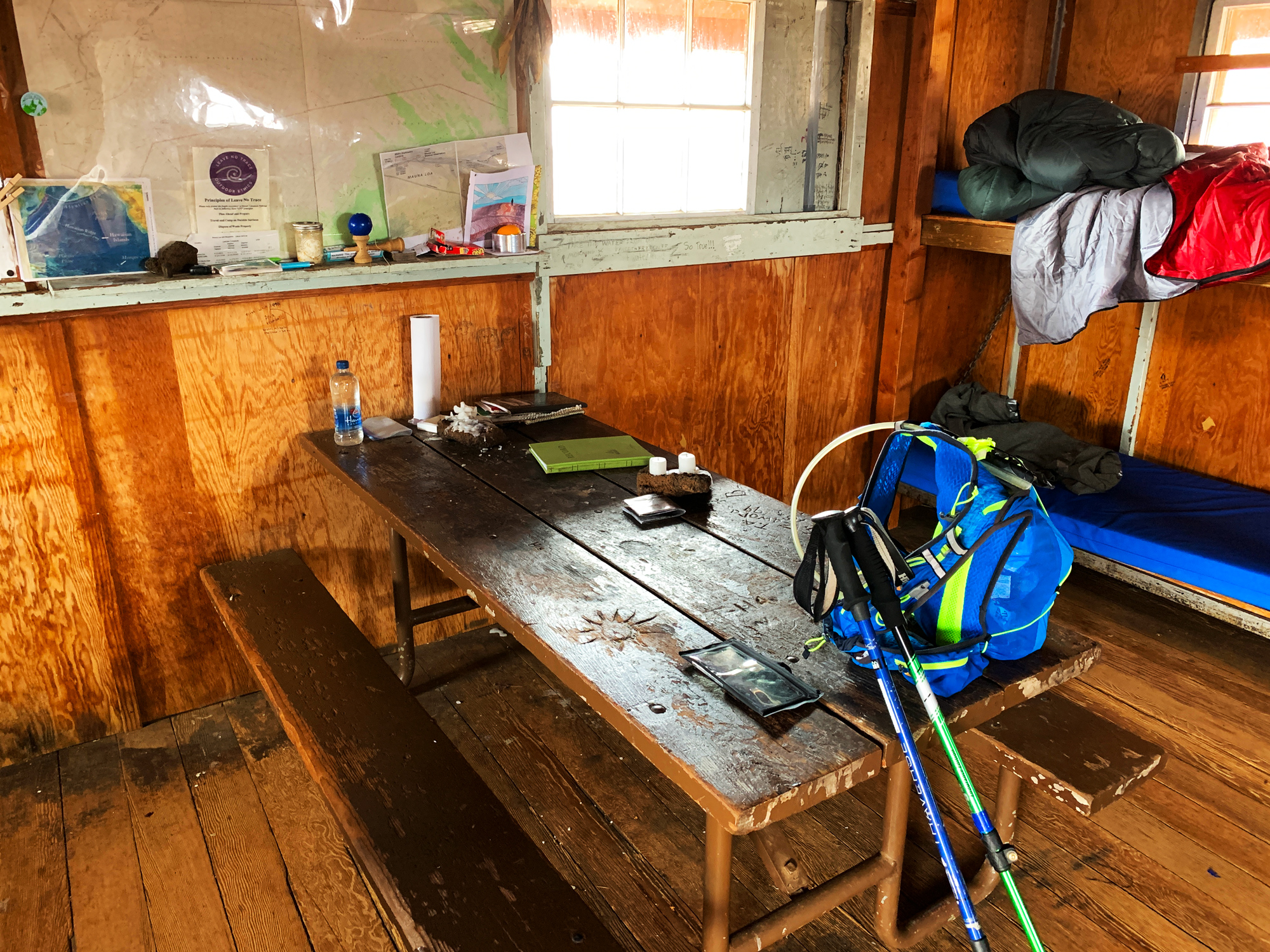
Once down to the cabin, I enter it and find a very cozy environment. Bunk beds, table, cooking area, and most importantly for me – water. I pull out my filter and make a quart of fresh water out of the catchment container next to the cabin. Quite the luxury in a sea of lava dozens of miles from the nearest water source. What also catches my attention is the fact there are a few spare sleeping bags just laying on a couple of the beds. I had heard about this and talked with a ranger a few weeks ago who explained they liked to keep them in the cabins since there have been a few “day” hikers that got themselves caught out here without the right equipment. And these sleeping bags really made a difference through the freezing temperatures over the night. Seemed like a good idea to me.
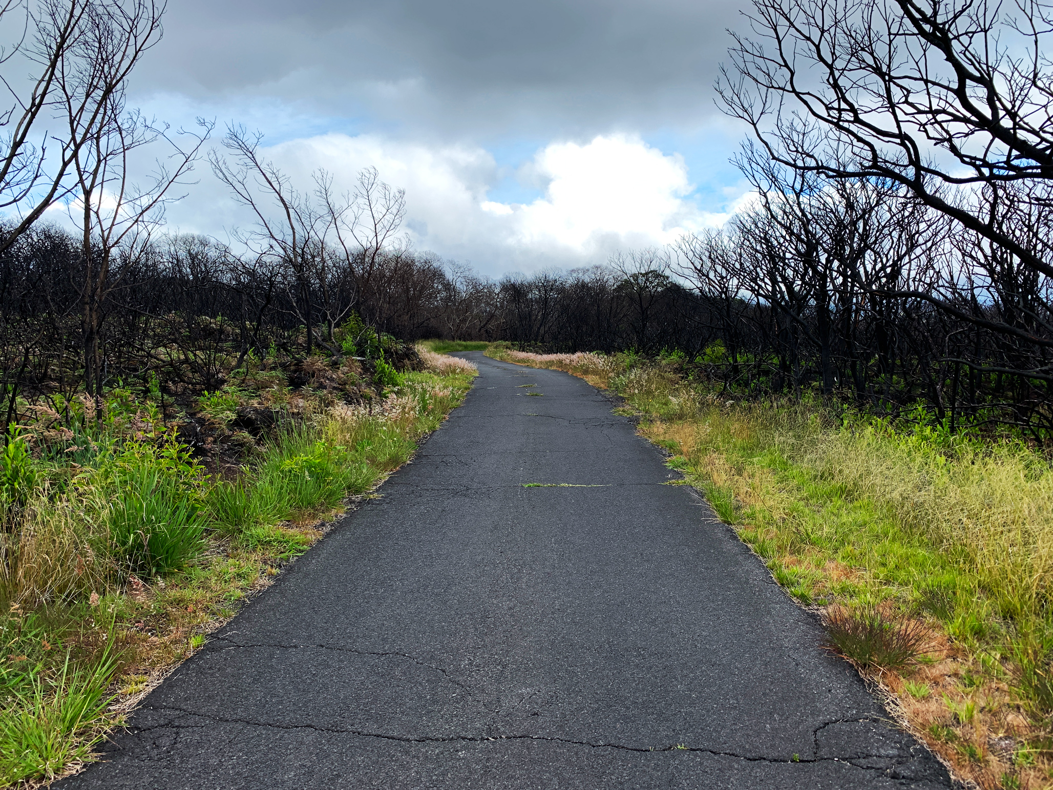
After exploring for around 20 minutes, I exchanged my wet shirt for a dry one from my pack, looked around to be sure I left everything the way I found it, and then headed down the trail. I stuck with my gameplan and walked the whole way down. By the time I reached the Mauna Loa Lookout at the top of the Strip Road, I was so done with this downhill beating. But I still had 11 miles to go and there was no one up here to catch a ride with (probably because there was no view from this rainy Lookout). So I kept walking down. Luckily I have a friend in Volcano I decided to call after getting halfway down the road. Honestly, I forgot how long it would take to walk 19 miles (at a 20 min/mile pace only 6 hours and 20 minutes – haa). She picked me up and dropped me off at the car and released me from the last 1,000 feet of descent. I was happy for that since my quadriceps were pretty sore the next day even without that extra descent. The rain had stopped an hour or so earlier and it was actually a beautiful late afternoon as I changed into my spare dry clothes. I stretched a bit basking in the warm sunlight. Then grabbed a few energy bars and a Powerade from my cooler jumped into the truck and drove south around Mauna Loa. Ninety minutes and 75 miles later I am passing the City of Refuge while chatting away with my mother when a thought occurred to me: I’m “still” on Mauna Loa. It’s funny to be reminded just how enormous this volcano is. I mention this to my mother and we digest that for a few minutes. Then we casually move on to the next topic as I drive through the night a little bit closer to home and the end of this long day.
Analysis of What I Learned From This Run
Overall there was quite a bit of takeaway from this run that I was not expecting. Because of the rain, I was able to test some elements of my gear better than I could before. And this gave me a better insight into what failed, what passed and what could use some tweaking. Below are the results:
What Failed
Shooting photos with my iPhone Xr through a Bontrager waterproof enclosure was a bust. Very grainy images that looked good on the phone but when imported to my computer looked grainy. No more photos or videos shot through what was, in essence, a plastic bag. To be fair, I discovered later that it is more of a waterproof wallet and not really designed to shoot photos through. So, my bad there. Seems obvious now that it would suck – ha. I also did a serious rookie move with the GoPro and forgot to bring a spare battery. After getting one video shot with the GoPro it would never turn back on again. I would pull out and put back in the battery over and over and basically, it was like the battery was dead. Back at my house, I would discover it had discharged itself and was dead. Lesson learned: minimum 2 batteries. I need a better container for the GoPro as well. At the moment I’m just using an athletic sock and that got soaked and kept the GoPro wet and fogged.
What Passed
These conditions also showed the gear that did well. And since I would start off wet at 4,000 feet and then go over 10,000 feet; if my clothing was going to fail it would be apparent. But the Salomon rain gear did a great job of keeping the rain out. Though the outerwear not being breathable, ensured that the shirt below was soaked. Yet as long as I was moving, I was toasty. And I anticipated this which is why I brought another long-sleeve to put on when I turned around and headed back. At that point, my effort was so low heading down I never really broke a sweat and that shirt stayed dry. My socks and Hoka Shoes were in various stages of sloshy soaked to mostly dry feeling throughout the day. No blisters formed and I honestly forgot about my feet even being wet after an hour which to me says the shoes and socks worked out perfectly. But that being said, I will have a spare dry pair of shoes and socks ready for me 34 miles into the actual Sea to Summit day. Might as well give myself as much advantage as possible.
Since I am doing the first 34 miles by myself, I started training with music out on the road. I typically have music on my trainer and treadmill at home but normally I like to be one with nature when outside. But the music can be a good distraction from the overall discomfort of an adventure like this so I used my Bluetooth waterproof headset (Backbeat FIT) and got over 9 hours of battery life out of it. Which is impressive given the company claims you can get 8 hours of listening time. On the Big Day, I’ll use it off and on from the ocean up to the end of the road 34 miles away and then be done with it. And it has proven it can handle that long of a run and the rain so it’s a winner in my book.
What Needs Improvement
My phone was down to 25% by the time I made it back to the truck. It was enough for this day but definitely not enough for the Big Day. I have a few apps I needed open which were drawing power such as Gaia GPS app, Garmin Connect app (for LiveTracking), the camera app, and, for the first time, the Amazon Music app. On Mauna Kea, I had my phone plugged into an external battery on the run for a few hours just to be sure the battery made it the whole way. This time around I bought (yesterday) a battery case for the phone so it would be one less thing to think about.
The Garmin inReach Satellite Tracking System worked very well evidently and everyone received the test text messages I sent and could follow me the whole way. What was annoying though is I was supposed to be able to control it from my watch but instead, for 11 hours the watch would beep at me a few times an hour and tell me it lost connection with the inReach device which was only 2-3 feet away from the watch in the top of my pack. That got old fast. So I will be turning that feature off for the Big Day. Also evidently it logged only 26.5 miles of the 33.2 miles I actually covered. When you view the map it seems to get the start, turnaround, and end points correct but somehow missing the distance by a huge amount. Not a big deal since it’s primary purpose is to let my family know where I am and that I am still moving. But still, it’s far from perfect as a tracking device for everyone else to follow. And this brings up my other tracking service: Garmin’s LiveTrack. This is run purely from my watch (Garmin Forerunner 935) and cellular (AT&T service) from my iPhone Xr. And on the Volcano Village side of the island, AT&T reception is notoriously bad. But oddly the family was able to track me pretty well on this run. Lots of dead areas where they saw nothing happen but then I guess my phone would be able to connect and would update all the info it missed. This is far from the perfect tracking system to share with everyone as well. It has some buggy bits like missing elevation gain accumulation on one-mile updates from time to time and then starts back to zero again. Or the BIG issue: just failing altogether when I start it. I’ve had this happen twice and my phone and watch said it was started but I found out later it just showed a dead page to track. Yet baring these issues, overall I think it gives more interesting data to people who are following along with me. You can see my heart rate, minutes/mile pace, elevation gain (however inaccurate it is), and all the relevant data on each mile split. So I’m going to run it as well on the Big Day but potentially recognize it might fail completely as it did on the Kilauea Sea to Summit.
Obviously, there are still some improvements to be made to athlete tracking and in particular within the backcountry. But we work with what we have. Twenty-five years ago the only way I could share this adventure with you was over a beer at the pub after it was all done. Which is still my preferred method of adventure story delivery – ha.
Summary
Ultimately this was a critical workout for me to have before the Sea to Summit run. And I think I got more out of it than I had ever expected. It was also amazing how surreal it is traveling through this environment when enshrouded in clouds, mist, and rain. I really wish I would have had the photographic equipment (and photographic eye) to capture the feeling of traveling through this space alone for hours. Which brings up another awesome thing about this workout: in the 11 hours I never saw one other human being until my friend picked me up. That is a perfect adventure in nature if you ask me and is exactly the opposite of what I experienced training on Mauna Kea. So with a midnight start at the ocean, I might get lucky and not see another human being for the whole run. That would be pretty magical for a Sea to Summit on this island. One can only dream.
Suggested Links:
- Interested in what the 4-hour walking descent looked like? – Workout File
Related posts
-
-

Hamakua Challenge Training – Pololu to Honopue – Out and Back
August 20, 2019
-

Hamakua Challenge Training – Waipi’o to Waimanu – Out And Back
August 19, 2019
Leave a reply